
The postcards never warned you. Endless glaciers, ancient trees, gravity-defying stone arches – these places feel eternal, carved so deep into America’s identity that losing them seems impossible. But a wave of 2025–2026 research is delivering a gut-punch reality check: 77% of U.S. national parks now face high climate vulnerability, and several of the country’s most iconic landscapes are already past the point of easy return.
This is the exclusive list – the latest on-the-ground revelations about 22 natural wonders that are actively disappearing right now. Some of what’s happening is faster, weirder, and more heartbreaking than the headlines let on. And a few of these places may surprise you.
Stick with it to the end, because the final section is about something the doom-scroll rarely offers: what actually works.
1. Glacier National Park’s Vanishing Glaciers
Hike the Highline Trail in Montana and you’re walking through a before-and-after exhibit that nobody asked for. When the park was founded in 1910, it had over 100 glaciers. Today, the number of named ice bodies large enough to qualify as active glaciers has dropped to just 25. Some have shattered into fragments – a 2024 USGS study found that 11 glaciers in the park have broken into multiple pieces, including giants like Blackfoot, Harrison, and Kintla.
Rangers report streams that used to roar now trickle or run dry by late summer. Wildlife that depended on glacial meltwater for cool, oxygen-rich pools is scrambling to adapt. Families who drove thousands of miles to show their kids the “Crown of the Continent” are standing in bare valleys, staring at dry rock where ice fields used to gleam.
Fast Facts
- 100+ glaciers present when the park opened in 1910; roughly 25 remain today
- 11 named glaciers have broken into multiple fragments, per a 2024 USGS study
- Some glaciers have lost as much as 85% of their area since 1966
- Winter snowpack in the park’s watershed has declined ~25% since 1946
- Scientists warn remaining glaciers will be “more or less gone” within decades
2. Sequoia National Park’s Giant Sequoias
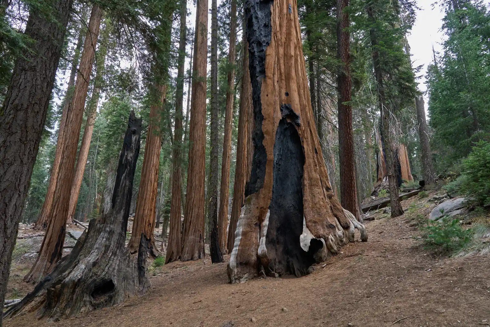
Some of these trees were already ancient when the Roman Empire fell. They’ve survived ice ages. They evolved specifically to withstand fire. And yet, recent mega-fires – made catastrophically hotter and faster by drought – killed an estimated 13 to 19 percent of all large giant sequoias in their entire native range in just the two fire seasons of 2020 and 2021 alone. The 2020 Castle Fire alone accounted for 10 to 14 percent of the world population. The 2021 KNP Complex and Windy fires added another 3 to 5 percent on top of that.
The General Sherman Tree still stands, the largest living tree on Earth by volume. But walk the surrounding grove, and you’ll pass blackened columns and collapsed crowns that have stood for two millennia. A 2025 study found that more than 17% of all mature giant sequoias have been killed by wildfire since 2015 – compared to less than 1% in the 30 prior years. The smell on those trails now is charred wood where it used to be something close to cathedral incense.
3. Joshua Tree National Park’s Iconic Cacti
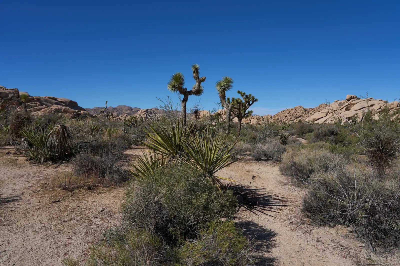
Joshua trees look like something Dr. Seuss sketched after a long night – twisted, reaching, utterly singular. They’ve defined the Mojave’s personality for centuries. But climate modeling projects up to 80 to 90% loss of suitable Joshua tree habitat within the park itself by 2100, and the brutal math is already visible on the ground.
Young trees are dying before they can reproduce. Shallow roots can’t reach deep moisture during droughts that now stretch for years. In 2020, the Dome Fire alone killed 1.3 million Joshua trees in the Mojave National Preserve – including most of the trees on Cima Dome, which scientists had designated as a prime climate refugia. Then in 2023, the York Fire swept through and killed roughly another million. Park visitors scaling the boulders at Wonderland of Rocks look out over patches of bare sand where clusters of trees stood a decade ago.
4. Everglades National Park’s River of Grass

The Everglades is the only place on Earth where alligators and American crocodiles coexist. It’s a slow-moving, 60-mile-wide river barely a foot deep in places, filtering water for millions of Floridians while hosting hundreds of bird species. And it is under assault from two directions at once.
Burmese pythons – released or escaped pets that found paradise in the subtropical ecosystem – have decimated small mammal populations by 90% in some surveyed areas. Simultaneously, sea-level rise is pushing saltwater inland, killing the freshwater sawgrass and mangroves that define the system. Airboat tours now glide through eerily quiet sawgrass marshes. The raccoons, opossums, and rabbits that once rustled at every waterway bend have largely disappeared into python bellies.
At a Glance
- Only place on Earth where alligators and American crocodiles share habitat
- Small mammal populations down 90% in python-surveyed areas
- Sea-level rise is pushing saltwater inland, killing freshwater sawgrass
- The Everglades Restoration Program is the largest ecosystem restoration effort in U.S. history
- Over 360 bird species depend on the system – many now declining
5. Saguaro National Park’s Towering Cacti
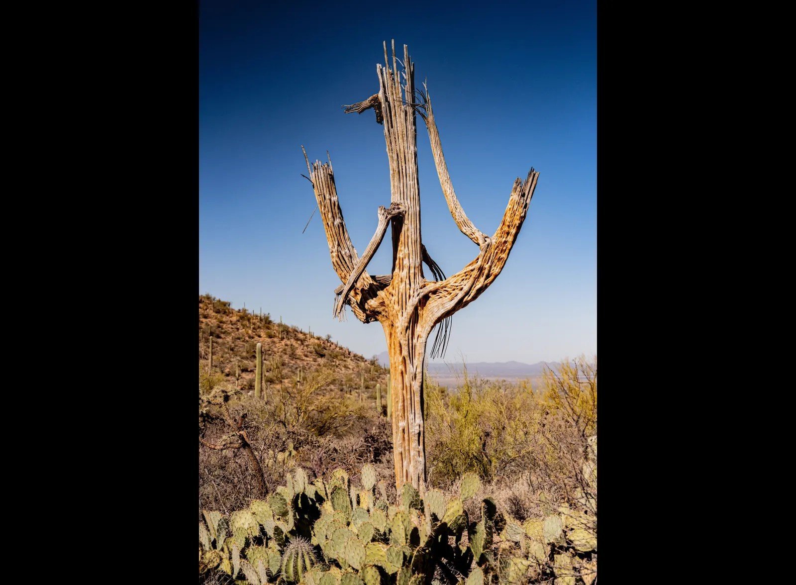
A saguaro cactus takes 75 years just to grow its first arm. The ones standing along the Valley View Overlook Trail today started growing before World War II. That slow, stubborn timeline is exactly why what’s happening now is so alarming – the damage being done won’t be visible for decades, but it’s already locked in.
Record heat and extended drought are causing “sagging,” where moisture-starved trunks lose structural integrity and collapse. Young saguaros – the next generation of the iconic Sonoran skyline – are failing to survive their first summers at rising rates. An ecosystem that evolved with predictable seasonal freezes and monsoons is being handed a climate it didn’t sign up for.
The Vanishing Wonders Quiz
Test your knowledge on the state of America's most iconic landscapes and the specific challenges they face in a changing climate.
6. Arches National Park’s Sandstone Arches
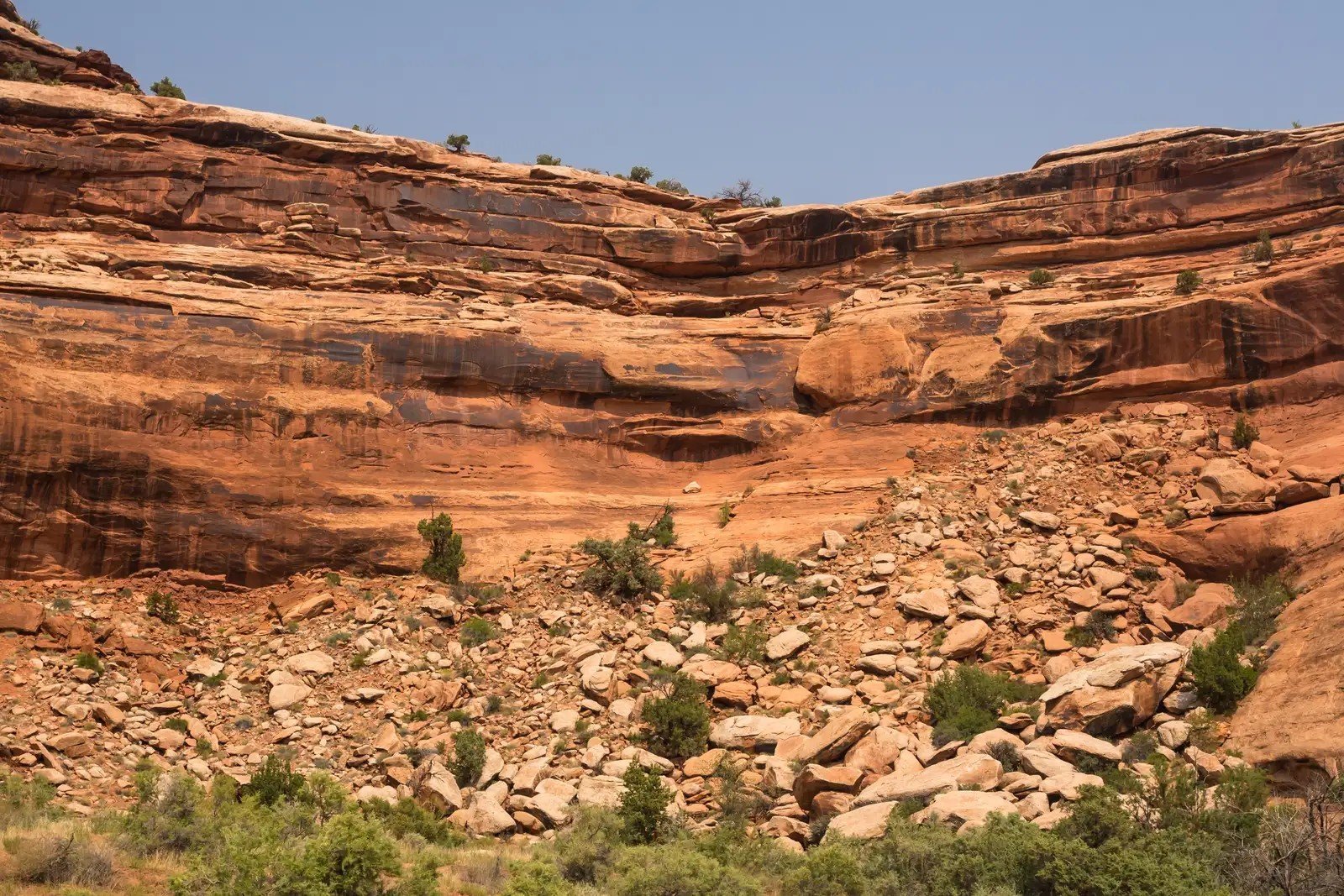
Wall Arch – a 71-foot span that appeared on park maps for over a century – collapsed overnight in 2008 with no warning and no witnesses. Hikers arrived at dawn to find rubble. It was a reminder that these structures aren’t permanent monuments; they’re temporary accidents of erosion, and some are closer to the edge than they look.
Dozens of arches and fins have collapsed in recent decades. Freeze-thaw cycles that crack sandstone from within are intensifying with more erratic winters. The park holds over 2,000 catalogued arches – more than anywhere else on Earth – but that number only goes one direction. Delicate Arch still burns orange at sunset. For now.
7. Great Salt Lake’s Shrinking Shores
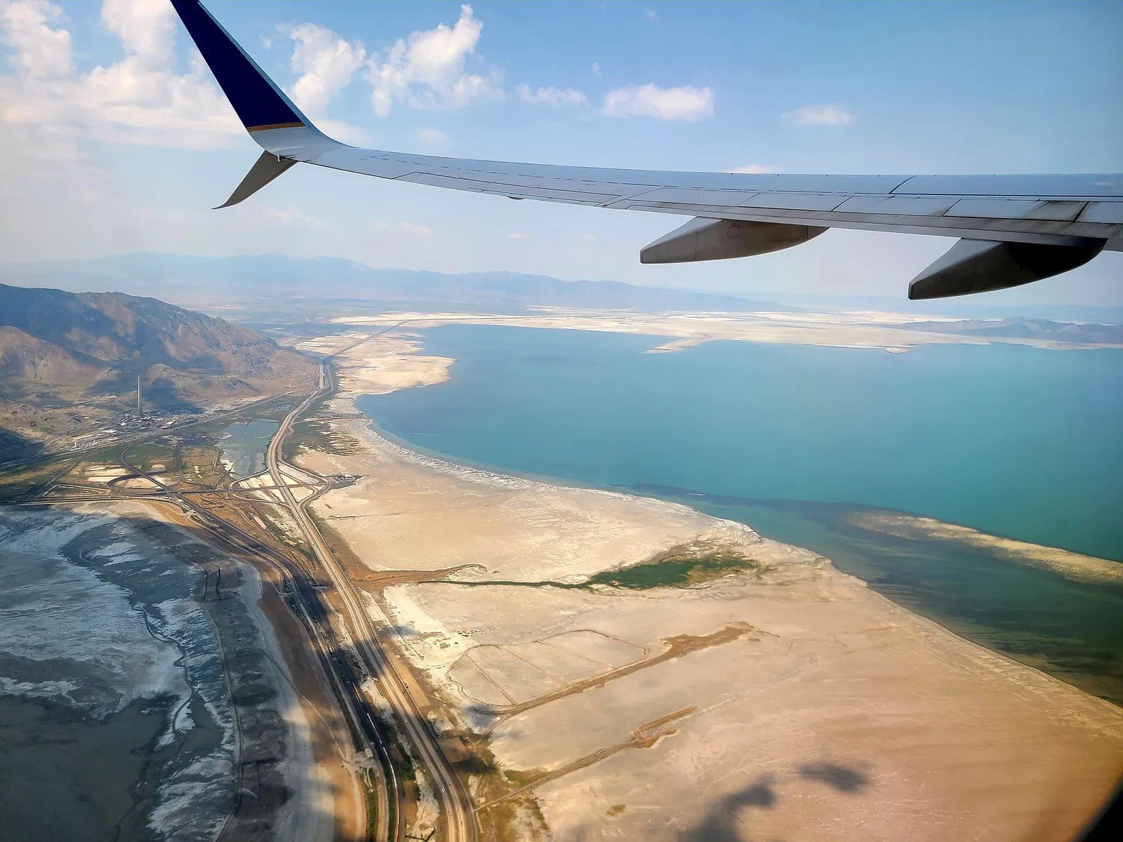
At its peak in 1986, the Great Salt Lake covered 3,300 square miles – larger than Rhode Island. It was a flyway hub for millions of migratory birds, a brine shrimp nursery feeding everything from gulls to grebes, and a climate regulator for the entire Salt Lake valley. The lake hit its all-time record low in November 2022. As of the 2025 water year, the south arm finished at its third-lowest recorded elevation since 1903, still sitting firmly within what scientists classify as the “serious adverse effects” range.
The exposed lakebed is the nightmare that doesn’t get enough coverage: dried sediment laced with arsenic, mercury, and other heavy metals, now available for the wind to carry directly into Salt Lake City’s air. Scientists have called it a looming public health crisis. Meanwhile, the brine shrimp populations that feed hundreds of thousands of migratory birds are collapsing as salinity swings past survivable levels. Experts say a sustained additional inflow of 800,000 acre-feet per year is needed just to return the lake to healthy levels by 2055.
Worth Knowing
- Historic high: 3,300 sq. miles (1986) – historic low hit in November 2022
- 2025 water year ended at the 3rd-lowest elevation recorded since 1903
- Dried lakebed dust contains arsenic and heavy metals blowing into Salt Lake City
- 800,000 acre-feet of additional annual inflow is needed to reach healthy levels by 2055
- Agricultural water use still accounts for ~65% of upstream diversions
8. Cape Hatteras National Seashore’s Barrier Islands
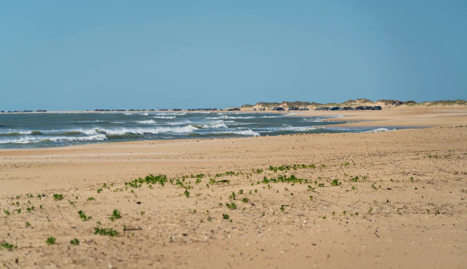
These North Carolina barrier islands were never meant to stay in one place – they naturally migrate landward over centuries as seas shift. The problem is that now they’re retreating faster than any point in recorded history, and there’s no room left to move. Developed coastline pins them from behind while rising seas push from the front.
The Cape Hatteras Lighthouse – all 198 feet of it – was moved nearly half a mile inland in 1999 because the ocean had already eaten the land beneath it. Wild horses still roam Ocracoke and Shackleford Banks, but nesting beaches for loggerhead sea turtles shrink every season. What’s being lost here isn’t just sand. It’s irreplaceable coastal wilderness disappearing into the Atlantic.
9. Biscayne National Park’s Coral Reefs
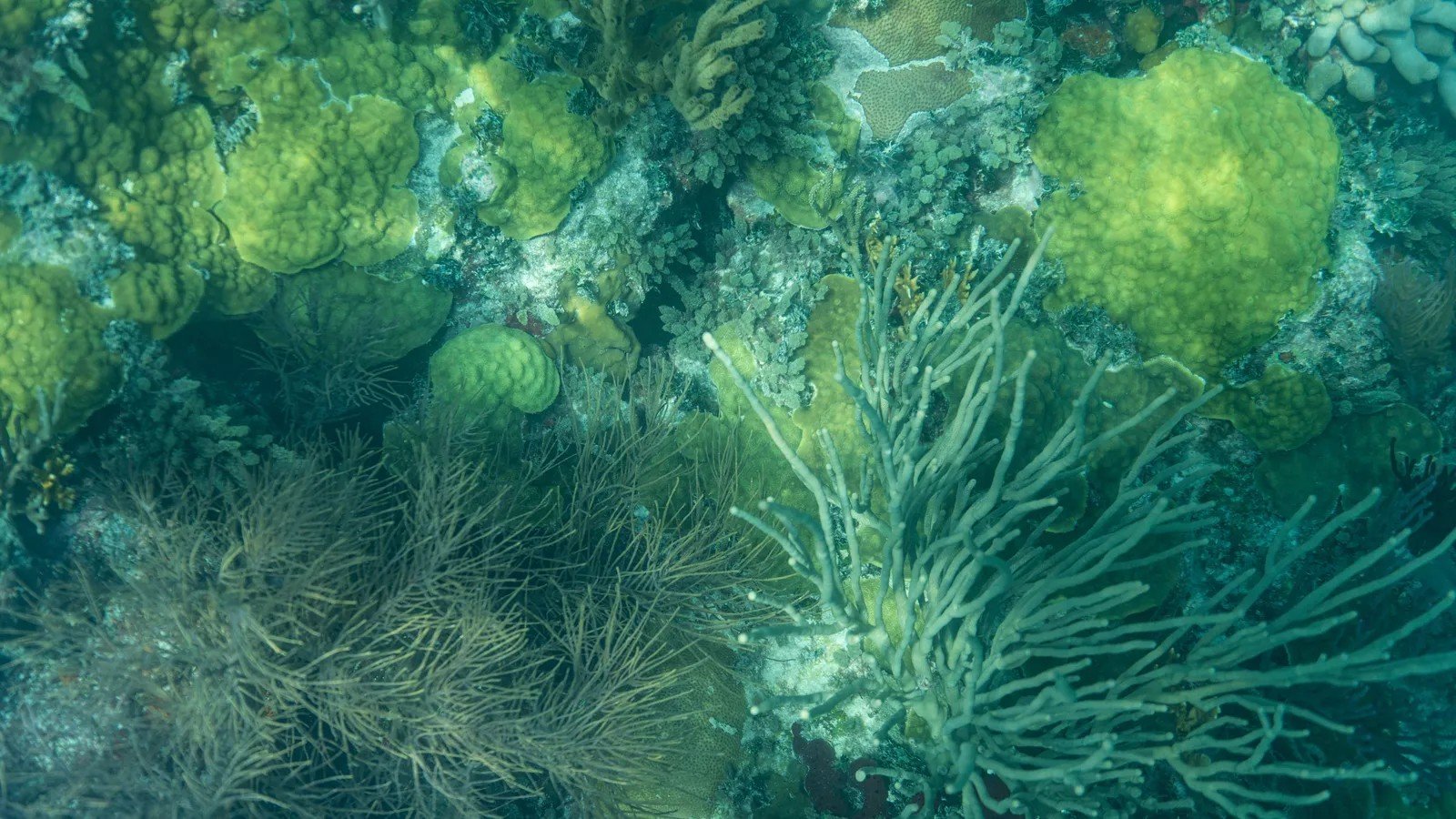
Ninety-five percent of Biscayne National Park is underwater, making it one of the most unusual parks in the system – and one of the most endangered. Florida’s coral reefs, part of the third-largest barrier reef system in the world, have lost roughly 90% of their coral cover since the 1970s. Warming ocean temperatures trigger bleaching events that leave behind white limestone skeletons.
The summer of 2023 was the most severe marine heatwave on record for Florida’s entire coral reef system – with cumulative heat stress nearly three times the previous record set in 2015–2016. Post-bleaching surveys spanning Biscayne south to the Dry Tortugas found that mean coral colony abundance fell 21% overall, with some species declining by 47 to 74%. Snorkelers who visited a decade ago and return today describe the experience as swimming over a graveyard. Parrotfish, angelfish, and rays still drift through – but the living architecture that supported them is fracturing.
10. Dry Tortugas National Park’s Low-Lying Keys
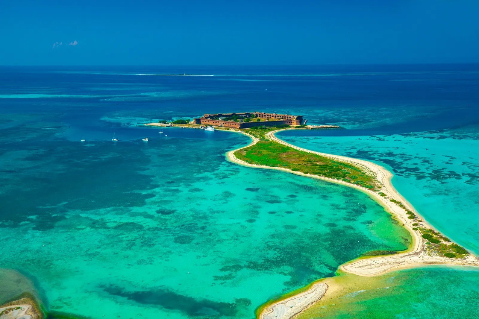
Seventy miles west of Key West, accessible only by seaplane or ferry, the Dry Tortugas feel like the edge of the world – a 19th-century brick fortress rising from turquoise shallows, surrounded by nesting seabirds and green sea turtles. That remoteness won’t protect it from sea-level rise projections that suggest up to two feet of inundation by 2100.
Garden Key, where Fort Jefferson sits, rises barely a few feet above sea level at its highest point. Storm surge from a single major hurricane can temporarily submerge the entire island. Sooty tern colonies – which nest on the ground – face increasingly catastrophic flood events during peak nesting season. The fortress walls have survived 150 years of weather. The ecosystem around them may not survive another 75.
11. Boundary Waters Canoe Area’s Pristine Lakes
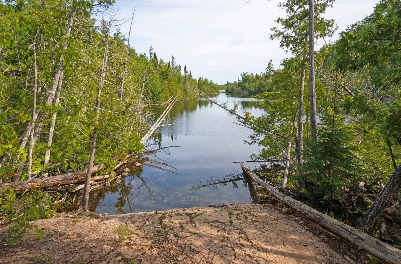
A million acres of boreal wilderness in northern Minnesota, the Boundary Waters Canoe Area Wilderness holds over 1,000 lakes connected by portage trails that Indigenous Anishinaabe people have paddled for thousands of years. No motors allowed. No roads into most of it. The kind of silence you can actually hear.
Proposed sulfide-ore copper mining on the wilderness boundary has been fought back repeatedly, but the threat resurfaces with each administration shift. Sulfide mining produces sulfuric acid when ore is exposed to water and air – a combination uniquely catastrophic for a landscape defined by waterways. A spill or chronic seepage in this watershed wouldn’t stay in one lake. It would move through all of them.
12. Arctic National Wildlife Refuge’s Coastal Plain
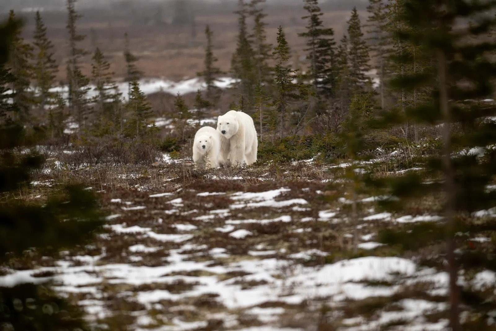
The Arctic National Wildlife Refuge’s coastal plain is the calving ground for the Porcupine caribou herd – roughly 200,000 animals that the Gwich’in people have depended on for subsistence for 10,000 years. It’s also where polar bears den, where millions of migratory birds nest, and where, since 2017, oil leasing has been legally authorized.
The Willow Project, approved in 2023 in the nearby National Petroleum Reserve-Alaska, intensified concerns about industrial infrastructure fragmenting the last truly wild coastal tundra in the U.S. Permafrost thaw from warming alone is already destabilizing the ground beneath the refuge. Add roads and drill pads, and the compounding effects on migration corridors and denning habitat are difficult to overstate.
Quick Compare: Threats vs. Scale
- Porcupine caribou herd: ~200,000 animals dependent on coastal plain calving grounds
- Migratory birds: Millions nest here annually from dozens of countries
- Permafrost thaw: Already actively destabilizing ground, independent of drilling
- Industrial risk: Roads and drill pads fragment corridors used for 10,000+ years
- Legal status: Oil leasing authorized since 2017; leases contested in courts
13. Big Bend National Park’s Rio Grande

Big Bend sits in the most remote corner of Texas, where the Rio Grande carves dramatic limestone canyons through the Chihuahuan Desert. The river is the reason everything here exists – the cottonwood galleries, the hot springs, the 450 bird species, the entire binational ecosystem. And in recent years, sections of it have simply stopped flowing.
Severe drought, upstream diversions, and rising temperatures have reduced the Rio Grande in Big Bend to disconnected pools during parts of the year – sections where you could walk across without getting your knees wet. Rafting trips that once ran Santa Elena Canyon have been cancelled mid-season. The river isn’t just a scenic backdrop here. It’s the circulatory system. And it’s failing.
14. Haleakalā National Park’s Summit Ecosystems
The summit of Haleakalā on Maui sits above the clouds and hosts one of the most unusual ecosystems on Earth – birds and plants that evolved in total isolation, found nowhere else on the planet. The nēnē goose. The noctuid moth. The silversword plant, which spends up to 90 years growing before flowering once and dying. And the honeycreepers: vivid, melodic birds that have been disappearing one species at a time.
Avian malaria, carried by invasive mosquitoes, has been devastating Hawaiian bird populations for decades. The only refuge has been high-elevation habitat too cold for mosquitoes to survive. Climate change is warming those refuges, pushing the mosquito line upslope. Scientists are testing a biocontrol technique using incompatible insect technique – releasing mosquitoes that suppress breeding – but the window is narrow. Over 100 species in this park face extinction pressure right now.
15. Angeles National Forest’s Mountain Forests
Twenty minutes from downtown Los Angeles, Angeles National Forest is where 10 million people go to escape – pine-scented trails, snowshoe weekends in winter, the headwaters of the LA River feeding reservoirs that supply the city. It’s the most visited national forest in America, and it’s burning with unprecedented intensity.
California’s fire season now runs essentially year-round. The combination of reduced snowpack, longer dry seasons, and high winds creates conditions where fires in Angeles burn hotter and spread faster than the forest can recover. Watersheds that took centuries to develop are stripped to bare mineral soil in hours. The ash that washes into reservoirs after fires forces closures and costly treatment – a cascade of consequences that flows directly into the taps of millions of Angelenos.
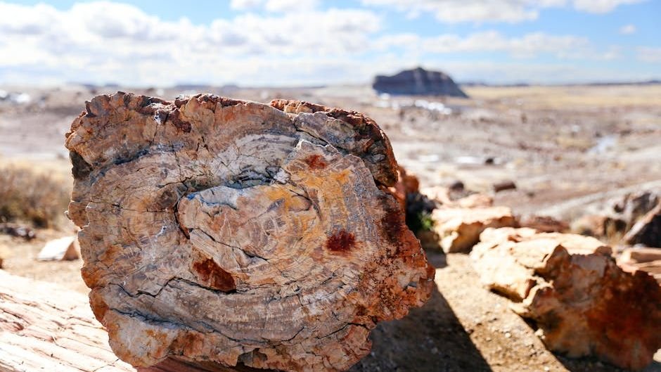
16. Petrified Forest National Park’s Ancient Logs
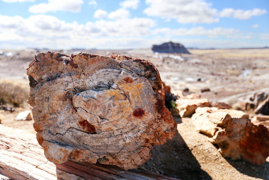
Walking through the Petrified Forest feels like wandering through a museum that nature built and forgot to lock. Two-hundred-and-twenty-five-million-year-old trees, turned to quartz crystal over incomprehensible spans of time, lie scattered across badlands in colors that shift from amber to violet depending on the light. Nothing else on Earth looks quite like it.
Accelerating erosion – driven by increasing rain intensity and drought-weakened soils – is fracturing these ancient logs faster than they formed. Theft has been a chronic problem for decades; rangers estimate tons of petrified wood are stolen by visitors annually despite strict prohibitions. Climate projections for the Southwest suggest the erosion rate will only increase. The park is essentially watching irreplaceable Triassic time dissolve in real time.
17. Lassen Volcanic National Park’s Pika Habitats
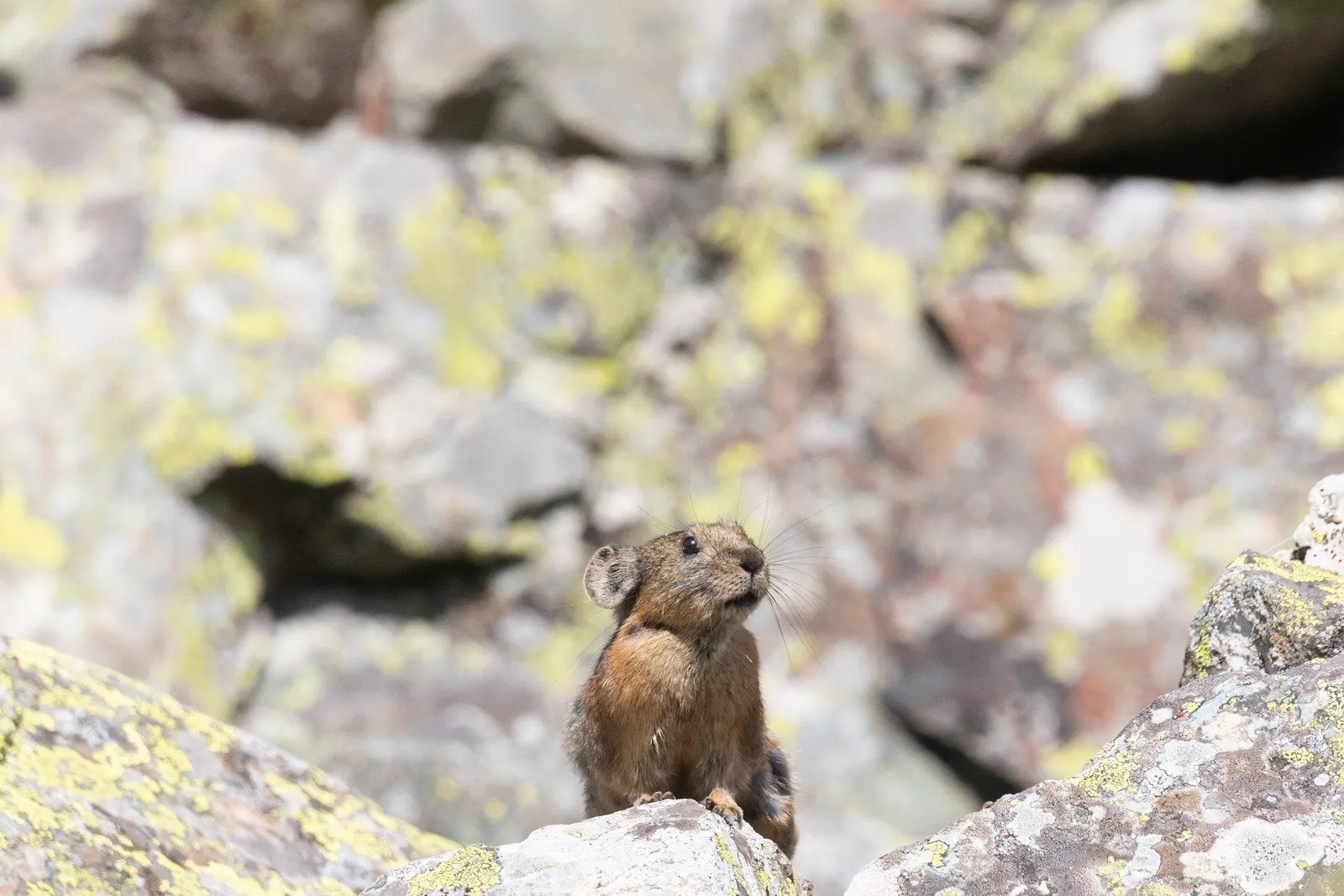
American pikas are about the size of a tennis ball, live among rocky talus slopes at high elevations, and cannot thermoregulate – meaning temperatures above roughly 75°F can kill them within hours. They don’t migrate. They don’t hibernate. When it gets too hot, their only option is to move upslope. And eventually, upslope runs out.
Lassen Volcanic in northern California is pika territory – a geothermally active landscape of steaming vents and alpine meadows where these small mammals whistle sharp warnings across boulder fields. Researchers have documented local pika extinctions at lower elevations across the Great Basin and Sierra Nevada as warming closes off their thermal refuges. Their disappearance from Lassen would be a quiet event. It would also be a precise early indicator that the mountain’s entire cold-adapted ecosystem is unraveling.
Why It Stands Out
- Pikas can die within hours of exposure to temperatures above ~75°F
- No migration, no hibernation – upslope retreat is their only survival strategy
- Local extinctions already documented across the Great Basin and Sierra Nevada
- Their disappearance is a leading ecological indicator for entire cold-adapted mountain systems
- Lassen sits at the southern edge of viable pika range – among the most at-risk populations
18. Yellowstone National Park’s Hydrothermal Features
Old Faithful still erupts roughly every 90 minutes, drawing crowds who count down the seconds from wooden bleachers. The hydrothermal system beneath Yellowstone – thousands of geysers, hot springs, mud pots, and fumaroles – is the largest and most complex on Earth. It is also, in its own geological way, vulnerable.
Drought reduces the groundwater that feeds geysers, affecting eruption frequency. Wildfires, projected to triple in frequency across the Greater Yellowstone Ecosystem by 2100, are already transforming surrounding forests from dense spruce and fir into open grassland. The bison, wolves, and elk that complete the ecosystem’s famous predator-prey drama depend on those forests for winter cover and forage. When the forest changes, everything downstream in the food web changes with it.
19. Rocky Mountain National Park’s Spruce Forests

The view from Trail Ridge Road – America’s highest continuous paved highway – used to look like a green ocean of spruce and fir rolling down toward elk meadows. In many stretches now, it looks like a rusted steel brush. Mountain pine beetles, which once died back in cold winters, have exploded through drought-weakened forests in numbers that feel apocalyptic from above.
Dead standing timber creates fire risk that transforms forest floors. But the longer story is about what comes after – whether spruce and fir can regenerate in a warmer, drier climate, or whether the subalpine forests of the Rockies are in the early stages of converting to something else entirely. The elk bugling in the meadows below don’t know. Neither, honestly, do the scientists. Not yet.
20. Acadia National Park’s Rugged Coastline

Cadillac Mountain is the first place in the continental U.S. to receive sunrise between October and March, and the predawn parking lot fills before 4 a.m. with people willing to freeze for the privilege. Acadia’s pink granite coast, puffin colonies, and tide pools packed with sea stars and urchins are the reason 4 million people visit Maine every year specifically to come here.
Sea-level rise along the Maine coast is accelerating, and the 45 miles of hand-laid stone carriage roads that John D. Rockefeller Jr. funded a century ago – crossing streams and hugging cliffsides – are increasingly threatened by storm surge and coastal flooding. Salt marshes behind barrier beaches are drowning faster than marsh grasses can migrate inland. And the cold-water species in Acadia’s famous tide pools – defined by Maine’s frigid Gulf of Maine water – are being reshuffled as the Gulf of Maine warms faster than almost any ocean region on Earth.
21. Olympic National Park’s Temperate Rainforest
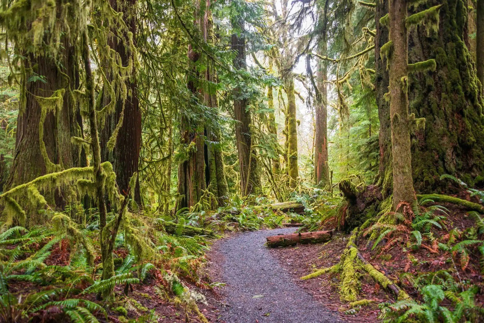
The Hoh Rain Forest gets up to 170 inches of rain per year. Sitka spruce and western red cedar grow so massive that their root systems create elevated “nurse log” nurseries where entire new trees sprout from fallen giants. Elk wander through halls of hanging moss. The air smells like something primordial. It is, by most measures, one of the most spectacular places on the continent.
On the drier, eastern edge of the Olympics, fire risk is climbing sharply as summer dry seasons lengthen. Old-growth forest stressed by drought becomes vulnerable to bark beetles – the same insects devastating forests across the Rockies and Sierra Nevada. The Hoh itself remains relatively intact for now, but the park’s ecological diversity depends on gradients of moisture and elevation that are being compressed from multiple directions at once.
22. Denali National Park’s Icefields
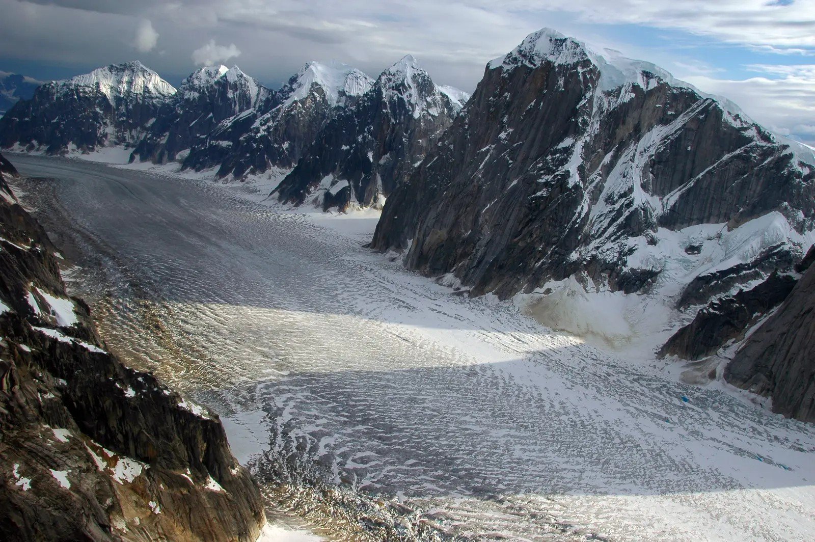
At 20,310 feet, Denali is the tallest peak in North America. Its glaciers – some of them 30 miles long and thousands of feet thick – have been retreating for decades. The Kahiltna Glacier, the main route for the 1,000-plus climbers who attempt the summit each year, is visibly thinner and more crevassed than it was a generation ago. Base camp managers have had to relocate operations as ice conditions change.
Beyond the climbing routes, glacier retreat in Alaska is accelerating faster than in almost any other region on Earth. As Alaska’s glaciers retreat, they have the potential to contribute significantly to sea-level rise, limit water supply to major rivers, and reorganize entire watersheds. Rivers running from Denali’s icefields carry meltwater that entire downstream ecosystems – including salmon runs and the grizzly bears that depend on them – have organized themselves around for millennia. That water is arriving earlier, and eventually, there will be less of it. The great mountain isn’t going anywhere. But the world it anchors is being renegotiated from the ground up.
How You Can Help Save These Wonders
Here’s the thing the doom-scroll never gets around to: individual action, aggregated at scale, has a documented track record. The Boundary Waters still exists because generations of paddlers showed up at hearings. The Everglades restoration program – the largest in U.S. history – exists because citizens and scientists refused to accept the alternative. These places aren’t gone yet, and what happens next isn’t fixed.
Start with the basics: reduce your own carbon footprint where it actually moves the needle – home energy use, flights, and diet have far more impact than swapping straws. Visit the parks, but visit responsibly – stay on trails, travel off-peak when possible, and book with operators who reinvest in the places they profit from. Donate to organizations doing direct work: the National Parks Conservation Association, the Nature Conservancy, and regional land trusts working on specific ecosystems all have documented impact.
Then use your loudest tool: your voice. Call or write your congressional representatives on specific legislation – the Boundary Waters protection bill, Florida reef restoration funding, the Great Salt Lake recovery plan. Share these stories. Not to perform outrage, but because the research is consistent on one point: public attention changes political calculus faster than almost anything else. The places on this list are still here. That’s still something worth fighting for.
At a Glance: Actions That Actually Work
- Reduce at home: Energy use, diet, and flights move the needle far more than small swaps
- Visit responsibly: Stay on trails, choose off-peak seasons, support operators that reinvest locally
- Give directly: National Parks Conservation Association, Nature Conservancy, and local land trusts
- Use your voice: Contact representatives on specific bills – reef funding, Great Salt Lake recovery, Boundary Waters protection
- Share the story: Public attention changes political calculus faster than almost anything else