
Most people think they know what “extreme” looks like. They picture a postcard. Something safely dramatic from a distance. But America’s most extreme landscapes don’t just look wild – they burn you, freeze you, swallow sound whole, and quietly rearrange everything you thought you knew about what the natural world can do.
This country holds more geological drama per square mile than almost anywhere on the planet – deserts that haven’t seen real rain in years, glaciers crashing into the sea, supervolcanic fields, prehistoric salt flats, slot canyons lit from above like stained glass. Here are 17 landscapes that prove the United States is in a category entirely its own. The last one might change how you think about American geography forever!
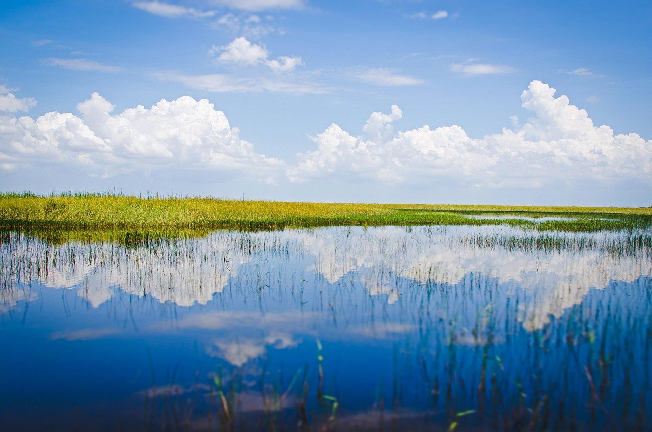
#17. The Everglades, Florida – The Slow River Nobody Sees Coming
 1
1
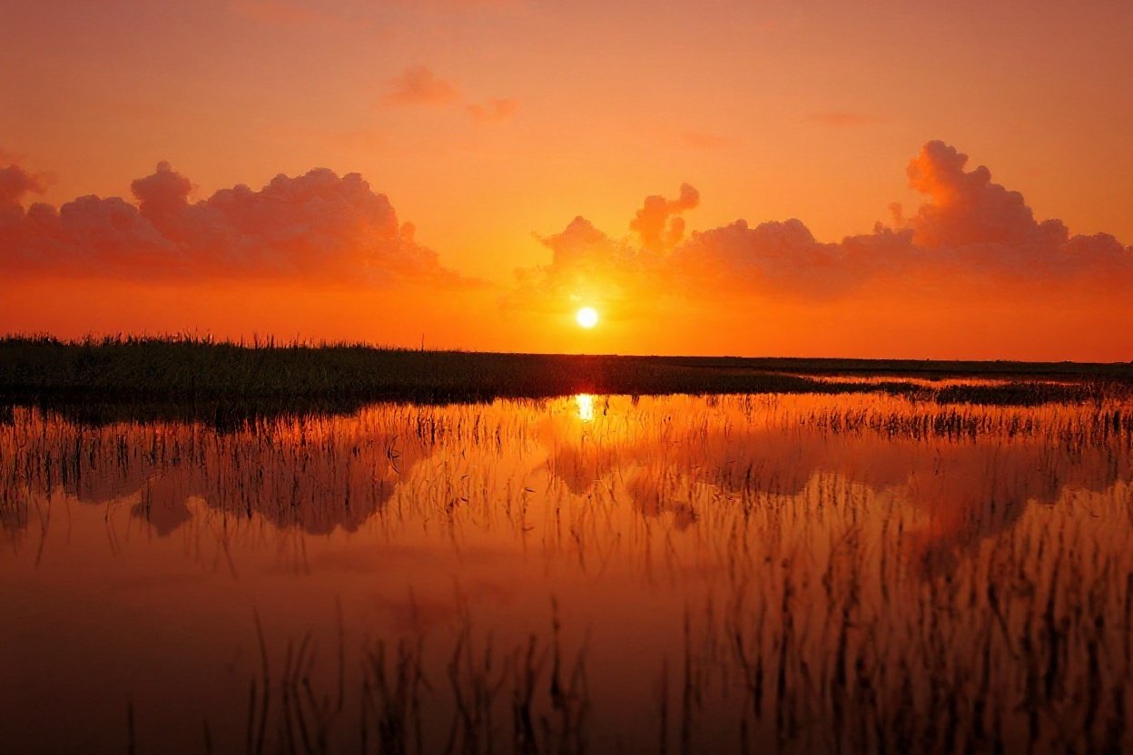
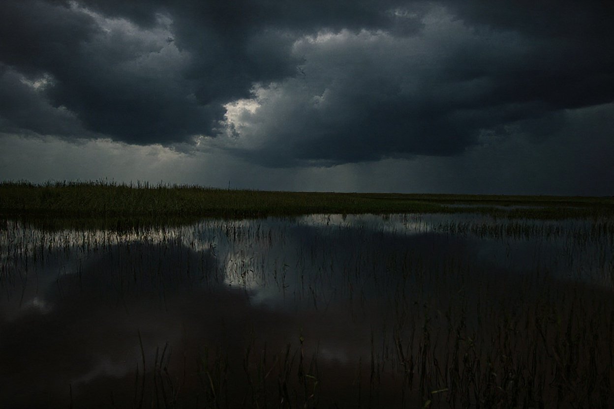
Most people picture a swamp when they hear “Everglades.” That image is completely wrong – and the reality is far stranger. The Everglades isn’t a swamp at all. It’s a wide, slow-moving river, created by the seasonal overflow of Lake Okeechobee. It doesn’t rush. It barely moves. But it never stops.
The Everglades is a subtropical wetland ecosystem spanning roughly two million acres across central and south Florida, and Everglades National Park alone protects 1.5 million of those acres, making it the largest subtropical wilderness in the United States. The water is so thoroughly choked with sawgrass that airboats replaced traditional propellers entirely. Walking through the Everglades feels less like a nature hike and more like trespassing inside a living organism that hasn’t noticed you yet.
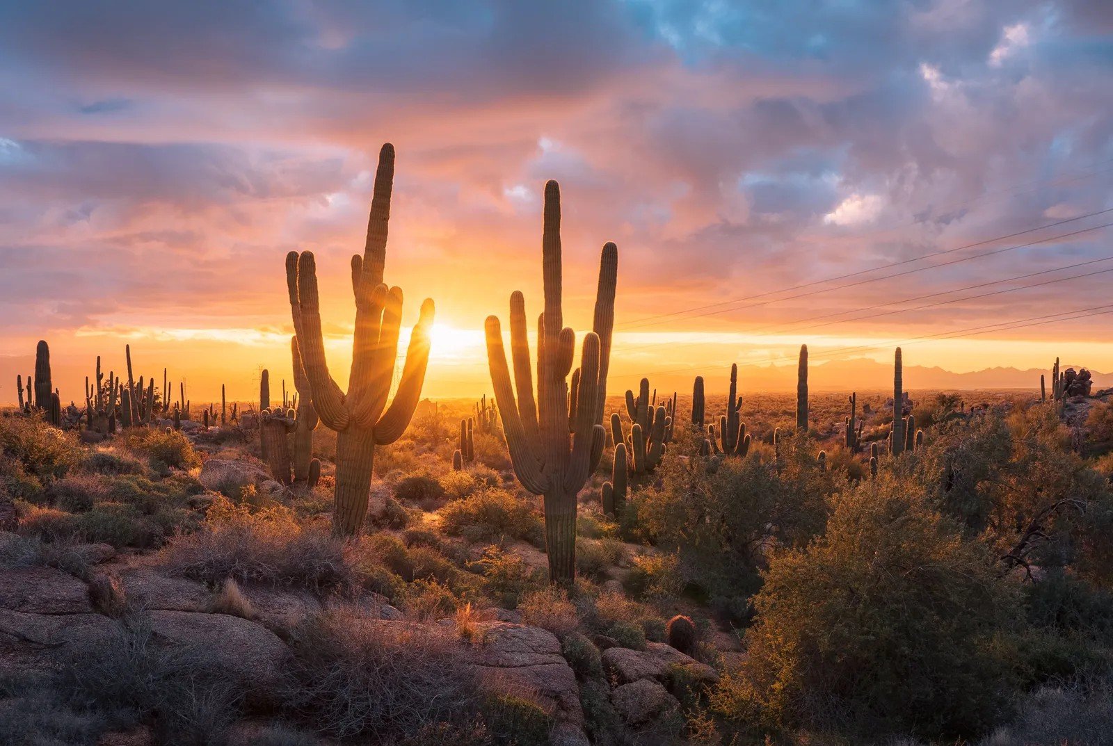
#16. The Sonoran Desert, Arizona – The Desert That Shouldn’t Be This Alive
 1
1
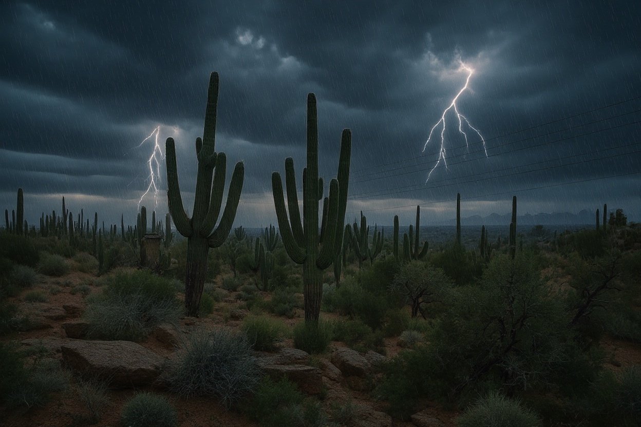
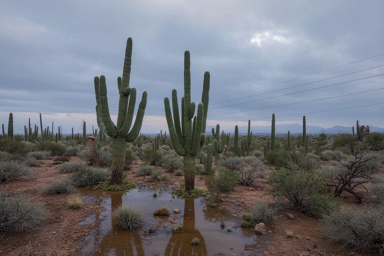
Most deserts are dead. The Sonoran is the exception that makes all the rules look ridiculous. Unlike every other major North American desert, the Sonoran receives precipitation twice a year – once in winter, once during summer monsoons. Even so, annual rainfall averages only 3 to 15 inches. By any logic, nothing should thrive here.
And yet this is the only place on Earth where the saguaro cactus grows naturally – towering green columns that can reach over 40 feet tall and live more than 150 years. Standing in a Sonoran field of them at sunrise, surrounded by giants with arms raised toward the sky, is one of the most quietly overwhelming experiences in American nature. It feels ancient in a way that’s hard to put words to.
Fast Facts
- The saguaro cactus can store up to 200 gallons of water after a single rainstorm
- The Sonoran Desert spans roughly 100,000 square miles across Arizona, California, and Mexico
- More than 2,000 plant species live here – the highest biodiversity of any North American desert
- Summer temperatures regularly exceed 110°F on the valley floor
- The desert hosts 60 species of mammals, 350 birds, and 20 types of bats
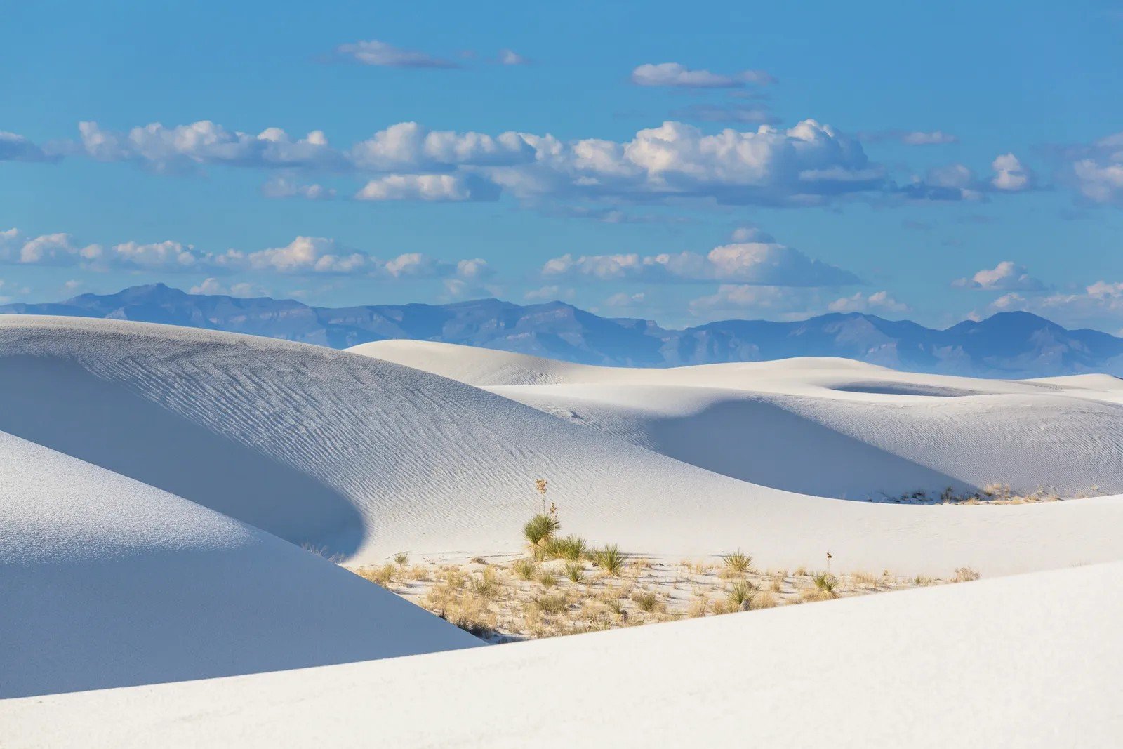
#15. White Sands, New Mexico – 275 Square Miles of Gypsum That Looks Like Snow
 0
0
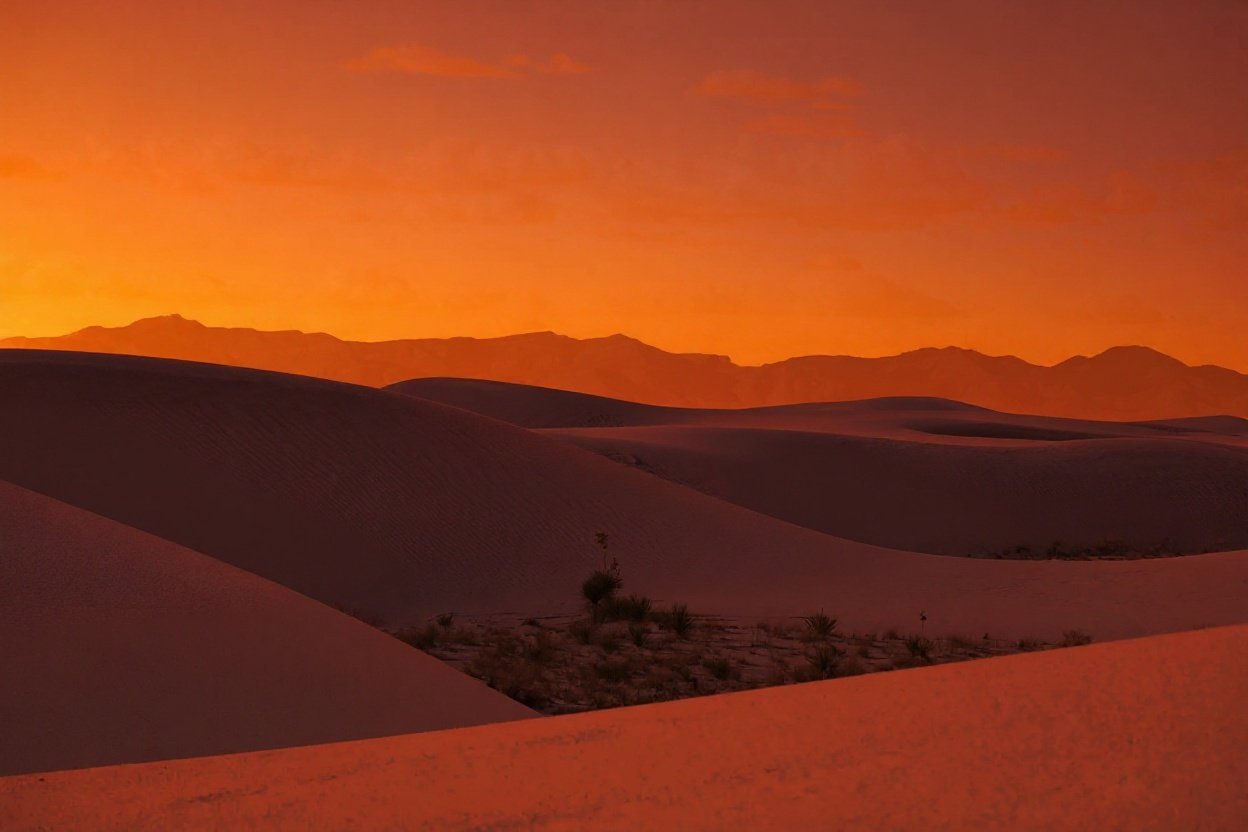
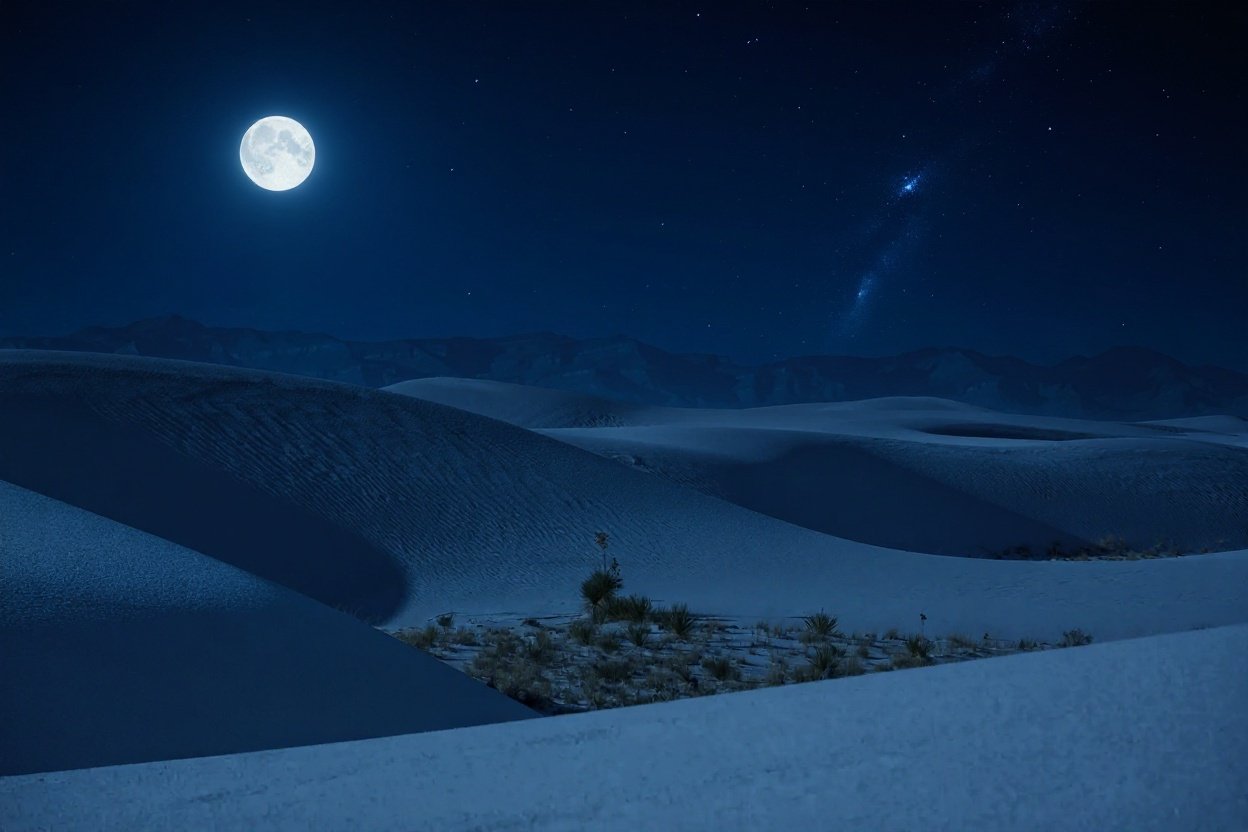
You pull off the highway in southern New Mexico and suddenly the world turns white. Not sand-colored white. Blinding, glittering, pure white – stretching in every direction as far as you can see. White Sands is the world’s largest gypsum dunefield, a place so visually alien that the U.S. military uses the surrounding region as a test range and has for decades.
The dunes shift constantly with the wind, burying plants alive and swallowing roads whole. There are no marked trails through the interior. You navigate by landmark – or you don’t navigate at all. Temperatures swing from freezing winter nights to scorching summer afternoons, and the gypsum crystals underfoot crunch like packed snow even when it’s 90°F. Nothing about this place feels like it belongs in the continental United States.
#14. The Great Basin Desert, Nevada – The Cold Desert Nobody Talks About
 0
0

Everyone knows the Mojave. Far fewer people know about the vast, freezing desert hiding in plain sight across Nevada. The Great Basin Desert is the largest desert in the United States, stretching across Nevada and into Utah, Oregon, and Idaho – and unlike its famous neighbors, this one buries you in snow. It’s a cold desert: brutal winters, blistering summers, and less than 10 inches of precipitation annually, most of it falling as snow.
What it lacks in warmth, it makes up for overhead. The Great Basin’s remoteness produces some of the darkest skies in the continental U.S. At Wheeler Peak and Great Basin National Park, the Milky Way doesn’t just appear – it dominates the entire sky in a way that makes city people go genuinely quiet. It’s the kind of darkness that recalibrates you.
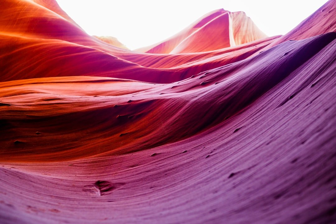
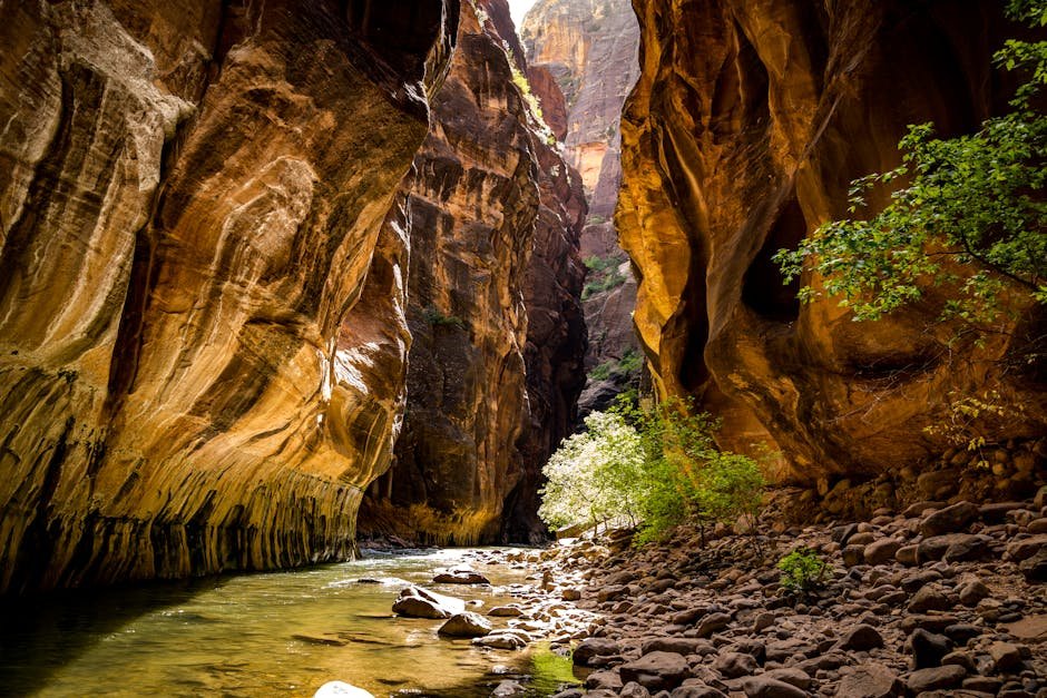
#13. Antelope Canyon, Arizona – Sandstone Sculpted Into Something Dreamlike
 0
0
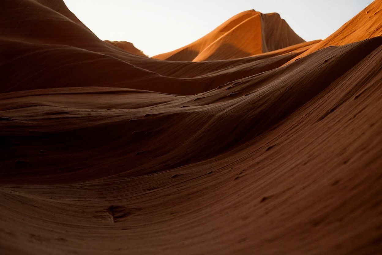
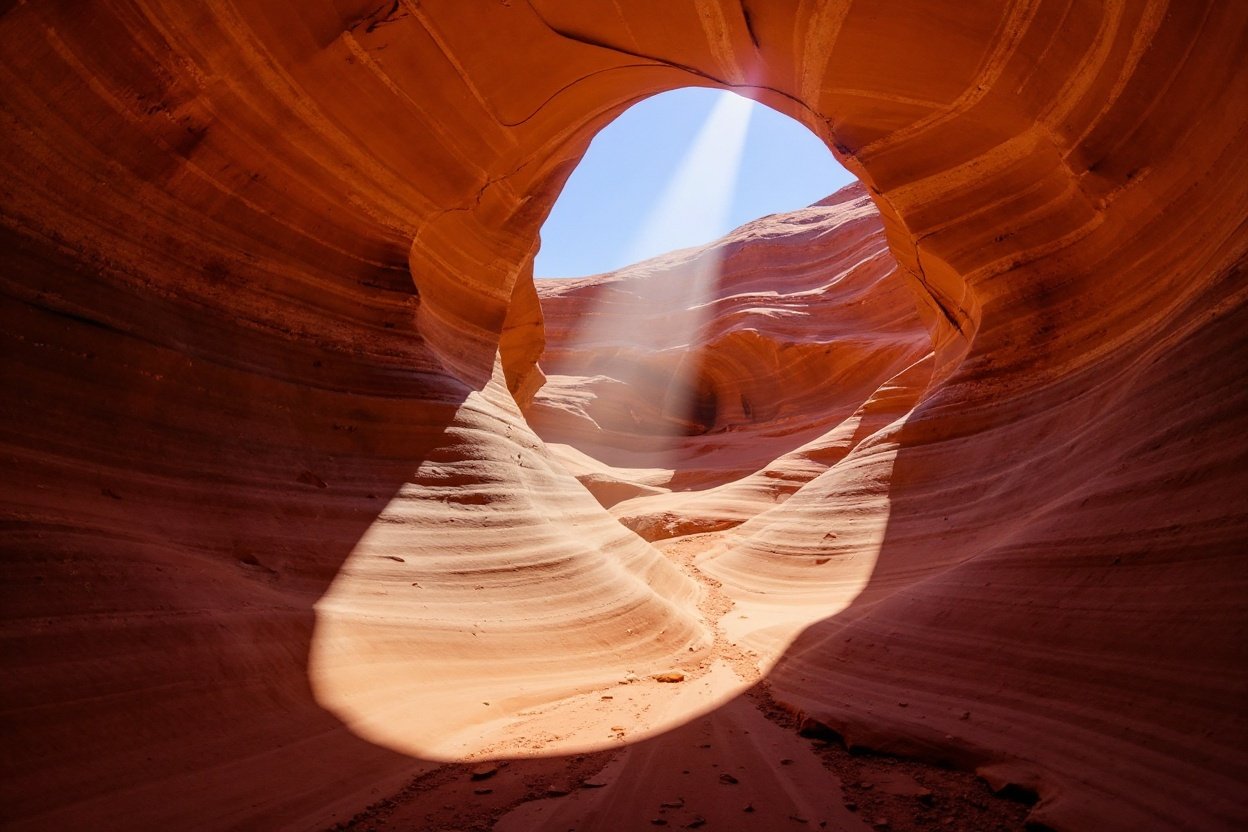
No photograph has ever done Antelope Canyon justice. Not one. Located on Navajo land near Page, Arizona, this narrow slot canyon was carved entirely by flash floods – thousands of years of violent, sudden water grinding sandstone into smooth, swirling corridors of fiery orange and deep red. The walls don’t look like rock. They look like frozen silk.
Stand inside at midday, and a single beam of light drops from a sliver of sky far above, illuminating the chamber like a cathedral. The walls practically glow. What the photographs miss is the scale – how close the walls are, how the colors shift every few feet, how completely the outside world disappears the moment you step in.
America's Extreme Landscapes Quiz
Test your knowledge of the most dramatic geological wonders in the United States, from the depths of Death Valley to the peaks of Denali.
Think you caught the key details? Take the quick quiz and see how sharp your instincts really are.
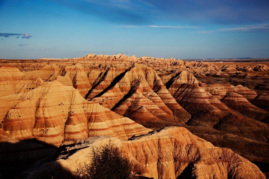
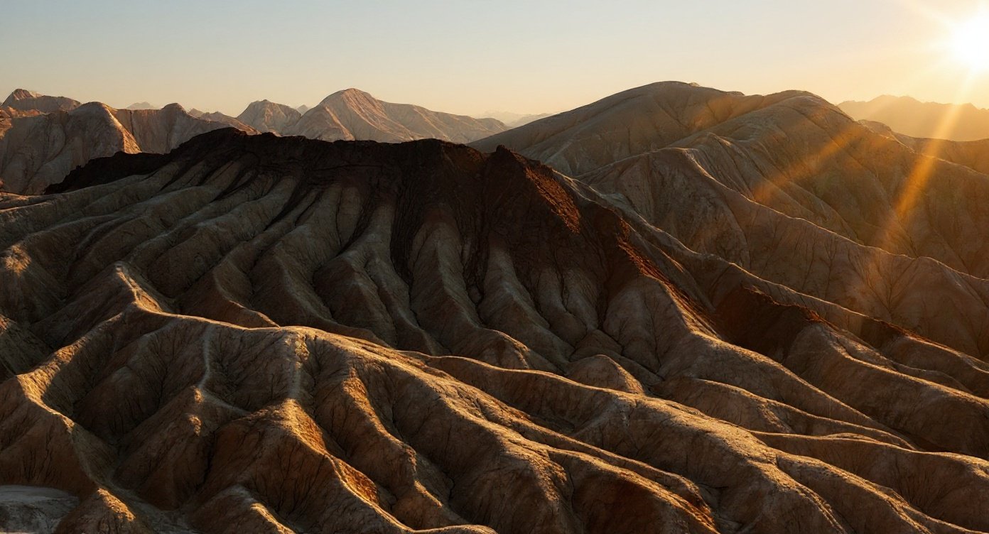
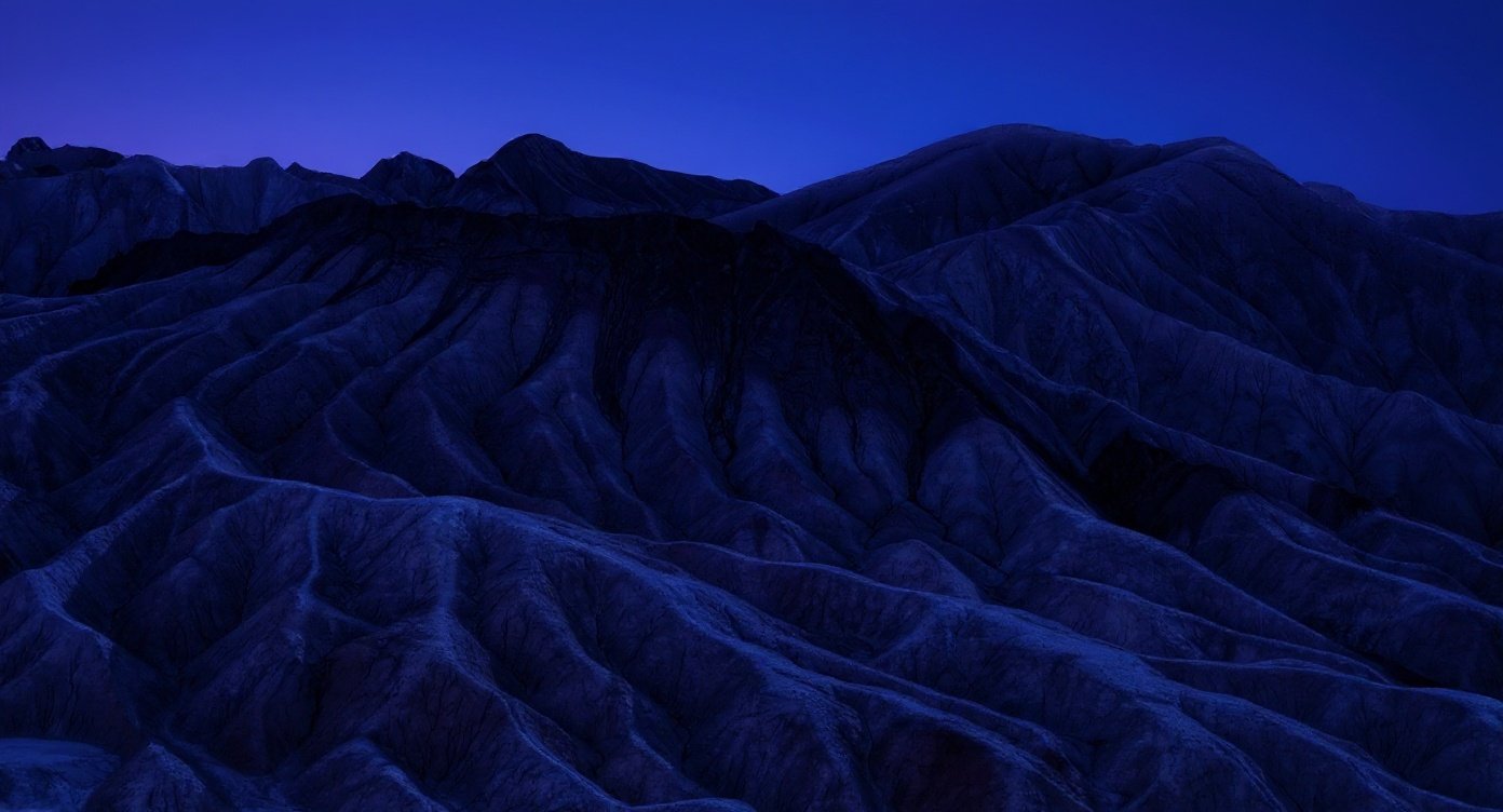
#12. Badlands National Park, South Dakota – Where the Earth Peeled Open
 0
0
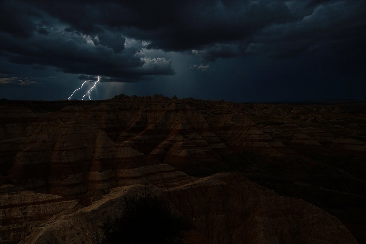
Driving into the Badlands for the first time, you get the unsettling feeling that something went catastrophically wrong here once – and nobody cleaned it up. Jagged spires, deeply eroded buttes, and channels cut into ancient rock in shades of brown, rust, and pale gray stretch to every horizon. It looks like a landscape assembled by something that had never seen Earth before.
The Badlands also sit at the mercy of the Great Plains weather machine. Without mountains or forests to slow them down, heat waves and Arctic air masses roll through uninterrupted. Temperatures can spike or crash by 50°F within a single day. Winds arrive without warning. Bighorn sheep, bison, and black-footed ferrets live here – survivors of a place that seems to be in the business of testing everything that tries to exist on it.
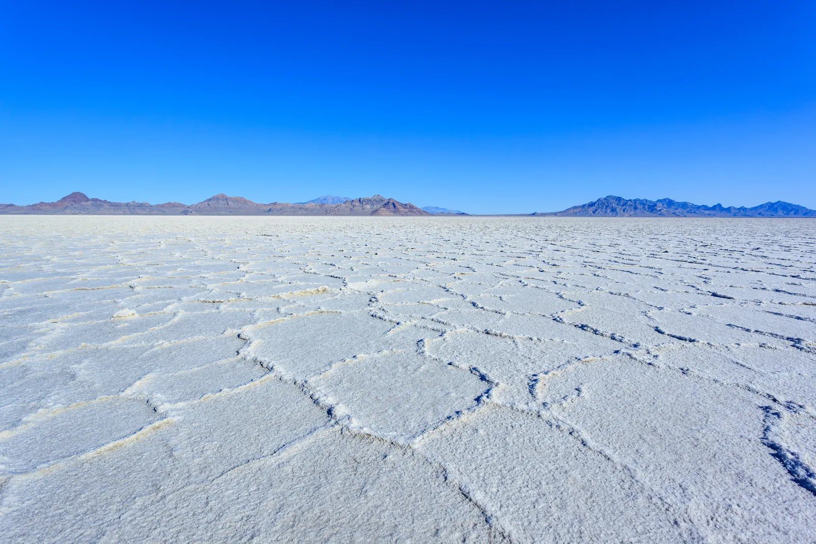
#11. Bonneville Salt Flats, Utah – A Prehistoric Lake, Now a Speed Track
 0
0
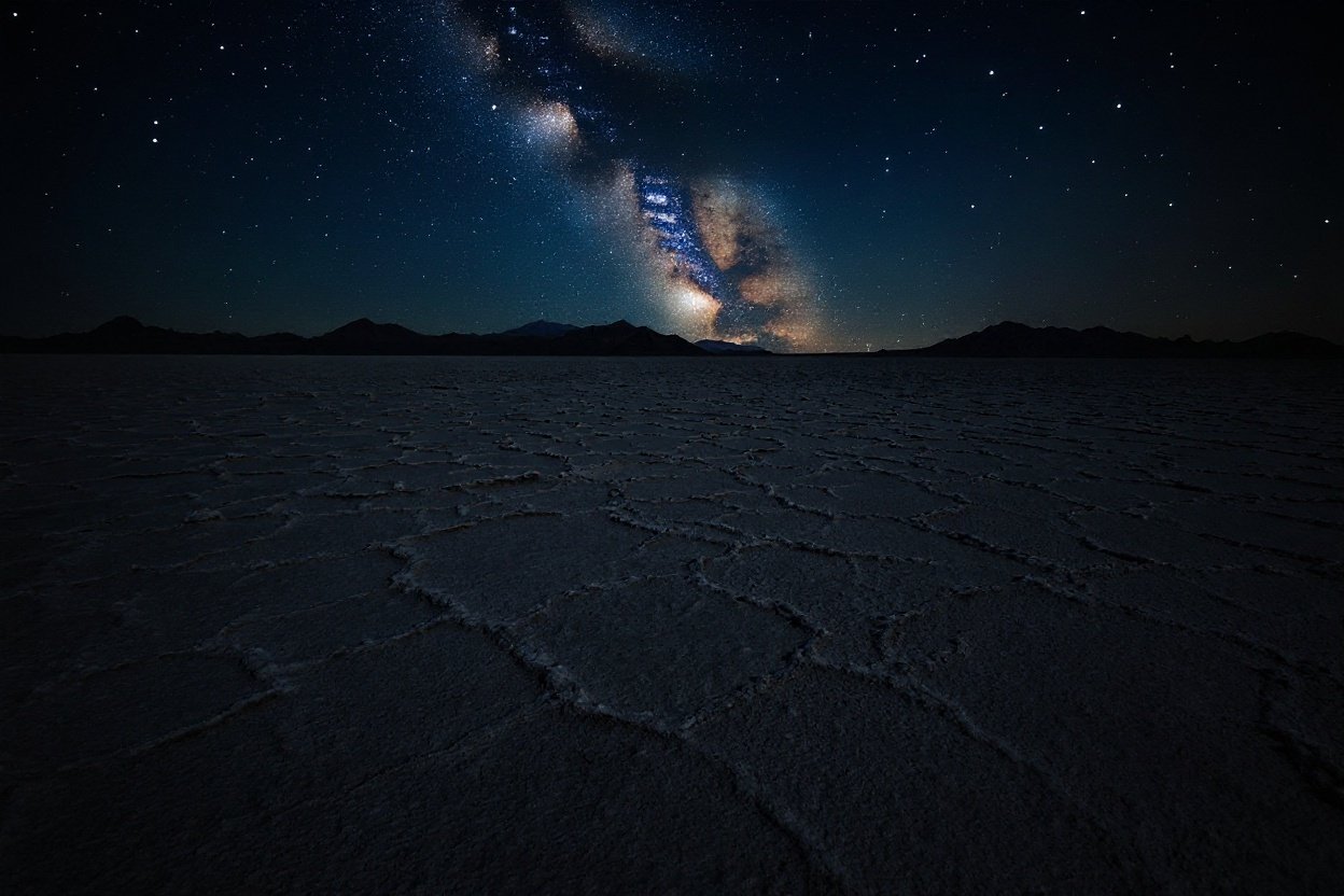
What you walk on at the Bonneville Salt Flats was once the bottom of Lake Bonneville – a Pleistocene-era inland sea that dried up roughly 14,500 years ago. When it did, it left behind a vast mineral crust of table salt, gypsum, and potash. The famous racing surface is about 12 miles long, with the crust historically up to 7 feet thick at its center – though decades of use and mineral leaching have thinned it considerably in places.
The surface is so perfectly flat and hard that land speed records have been broken here repeatedly. In August 2018, Danny Thompson set a new wheel-driven, piston-powered car record of 722.1 kph (approximately 449 mph) at Speed Week, driving a refurbished version of his father’s legendary Challenger 2. On hot days, heat waves rise off the white crust and create mirages so convincing that the desert looks like a lake again. The ancient water returning in illusion form, every summer.
At a Glance
- Original lake: Lake Bonneville, a Pleistocene inland sea that dried up ~14,500 years ago
- Salt crust: Historically up to 7 feet thick; now thinning due to natural and industrial causes
- 2018 wheel-driven record: ~449 mph, set by Danny Thompson in the Challenger 2
- Annual events: Speed Week (August) and World of Speed (September)
- Visibility: So flat you can see the curvature of the Earth from the surface
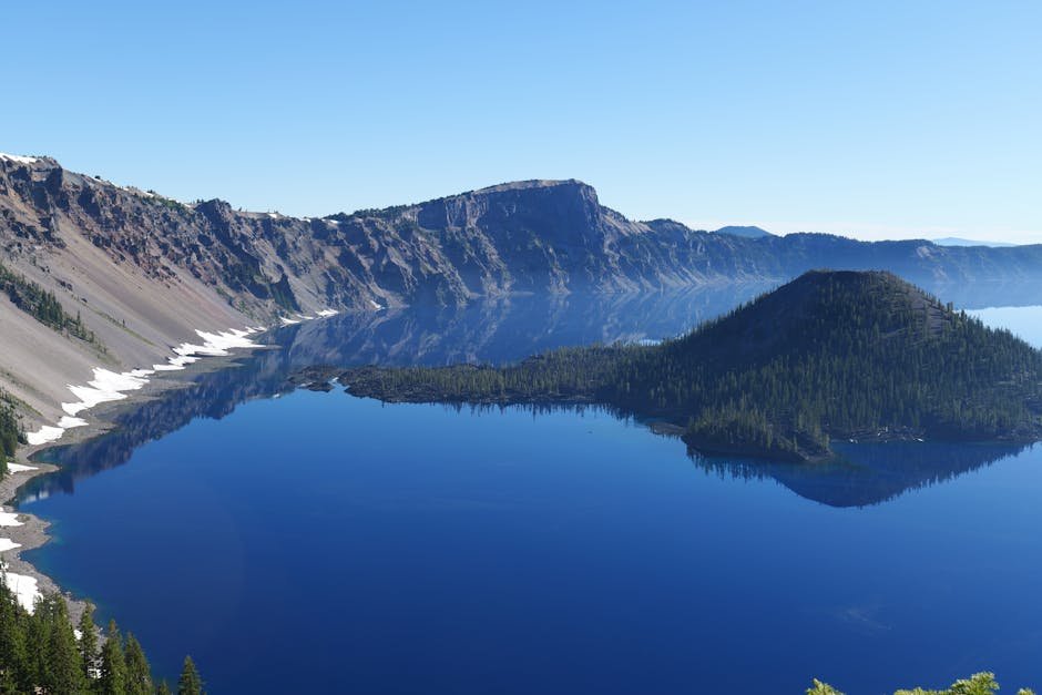
#10. Crater Lake, Oregon – A Volcano Swallowed Itself and Left This Behind
 0
0

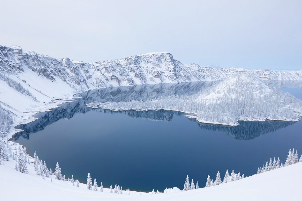
About 7,700 years ago, a volcano called Mount Mazama erupted so violently that it collapsed inward, leaving a caldera that slowly filled with rain and snowmelt. No rivers flow in. No rivers flow out. The result is the deepest lake in the United States at 1,949 feet – and one of the purest bodies of water anywhere on the planet.
That purity is why the color stops people cold. The water absorbs every wavelength of light except blue, which it scatters back upward like a polished gem. The blue here is not a trick of the sky or the season. It’s physics made visible. And somewhere in that depth, the “Old Man of the Lake” – a full-sized hemlock log – has been floating upright for over a century. Nobody has fully explained why it stays vertical. It just does.
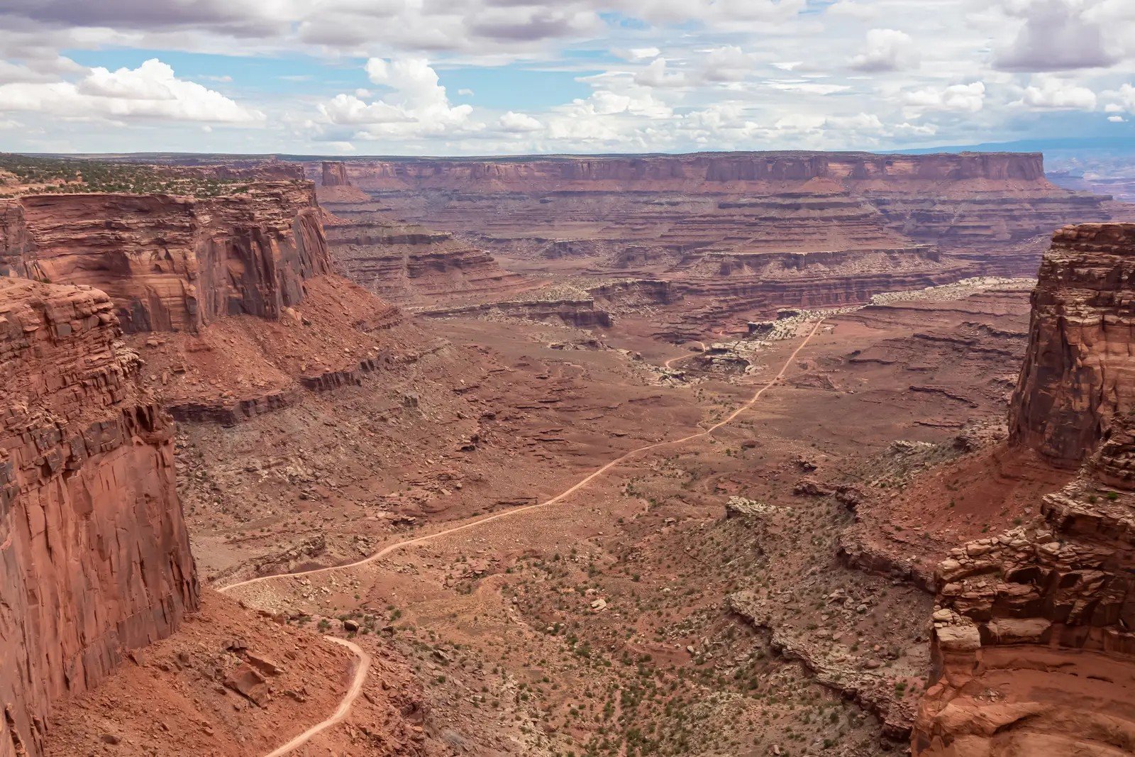
#9. The Colorado Plateau – Where Four States Share One Impossible Landscape
 0
0

The Colorado Plateau spans Utah, Arizona, Colorado, and New Mexico – a high-altitude, low-rainfall region averaging only 8 to 12 inches of precipitation per year. Within that dry expanse sits an almost embarrassing concentration of geological wonders: the Grand Canyon, Monument Valley, Arches National Park, Canyonlands, Bryce Canyon, and Mesa Verde, all within the same general region.
The combination of extreme aridity, violent seasonal flooding, and temperature swings has carved the plateau into a maze of deep canyons, towering mesas, and massive freestanding arches. Drive across it in a single day and you’ll feel like you’ve crossed three completely different planets before lunch. There is nowhere else on Earth quite like this convergence, and most of the world doesn’t know it exists in one continuous piece.
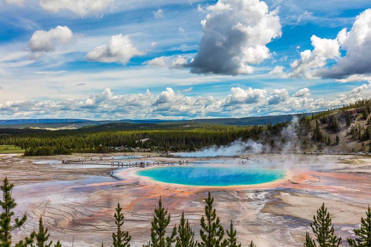
#8. Yellowstone National Park, Wyoming – A Supervolcano With a National Park Built On Top
 0
0


Yellowstone is not just a park. It is a window into the interior of the Earth. Sprawled over a dormant supervolcano, the park is one of the most geothermally active places on the planet – boiling hot springs, erupting geysers, and steaming fumaroles scattered across a landscape that looks peaceful right up until it reminds you what’s underneath.
The Grand Prismatic Spring, the largest hot spring in the United States, is a rainbow of microbial mats and mineral deposits that changes color with the seasons. It reaches 160°F at the center – hot enough to kill instantly. Meanwhile, the Yellowstone Thorofare, 32 miles from the nearest road, holds the title of the most remote location in the Lower 48. Grizzly bears, sudden storms, and subzero temperatures make it genuinely difficult terrain even for experienced backcountry hikers. Yellowstone plays by its own rules.
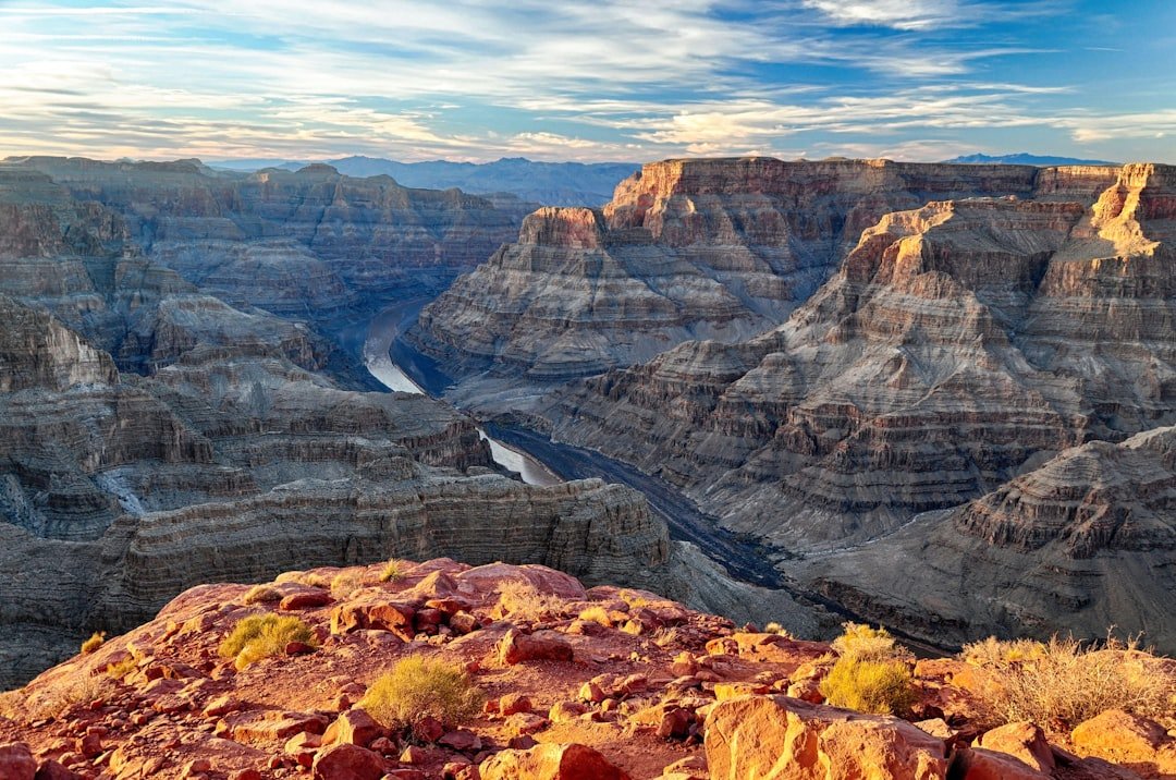
#7. The Grand Canyon, Arizona – Carved Over 17 Million Years
 0
0
The numbers people cite about the Grand Canyon – a mile deep, 277 miles long, up to 18 miles wide – don’t land until you stand at the rim and realize you cannot see the bottom. The Colorado River has been cutting downward through rock layers for roughly 17 million years, and what it’s revealed is essentially a timeline of Earth’s geological history exposed on a vertical wall.
Temperature at the rim and temperature on the canyon floor can differ by nearly 30°F. Hikers descend in cool morning air and hit desert-level heat by midday, miles from water and miles from any exit. Every season, rangers pull people out of the canyon who underestimated it. Every season, people are genuinely surprised it got serious that fast. The canyon doesn’t warn you. It just waits.
#6. Zion National Park, Utah – Slot Canyons That Swallow You Whole
 0
0
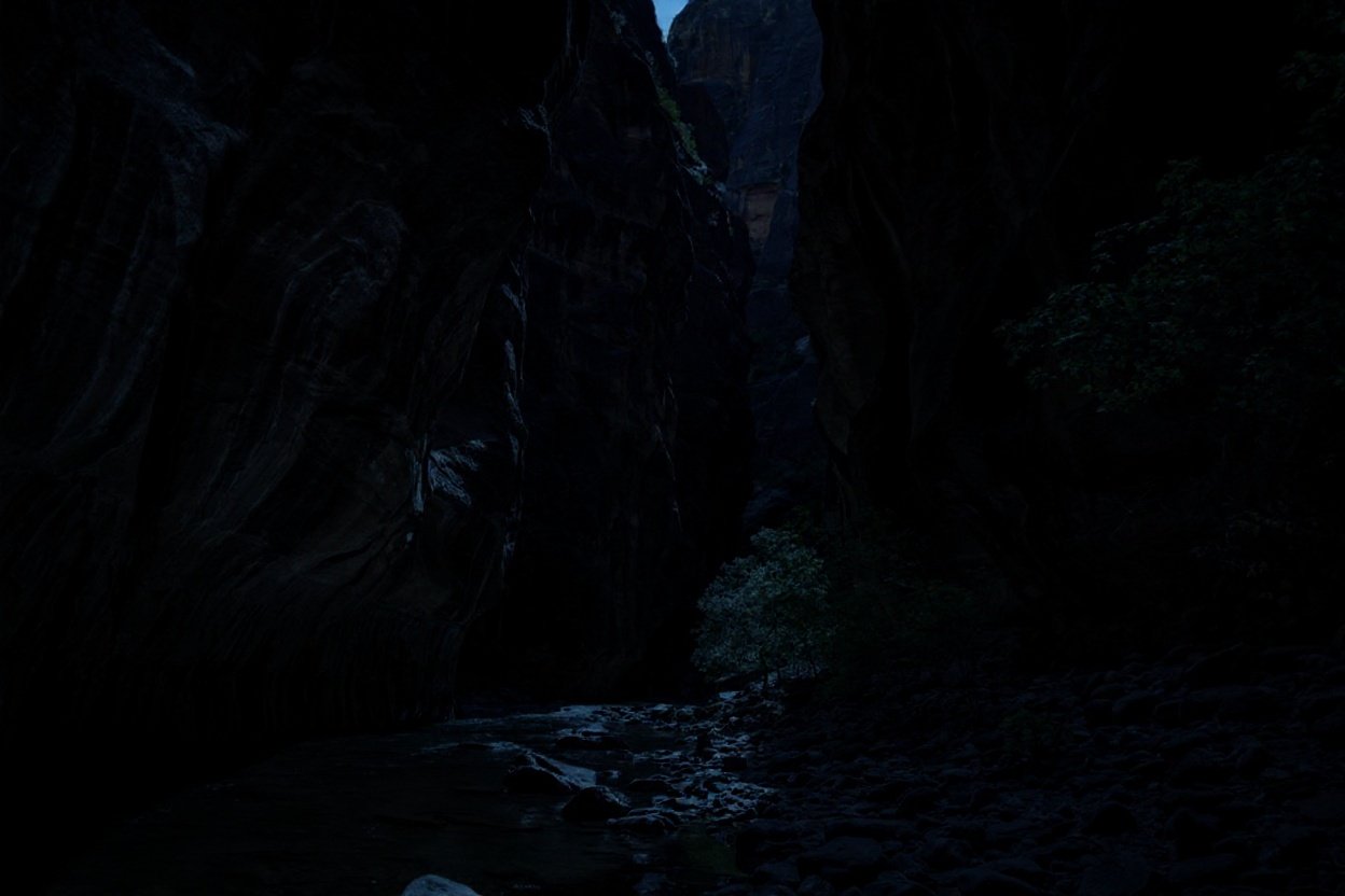

In Zion’s Narrows, you’re not hiking through a landscape. You’re hiking inside it. The Virgin River has cut a canyon so tight in places that your shoulders nearly brush both walls simultaneously, while the walls themselves rise nearly 2,000 feet above you. Light comes down through a strip of sky so narrow it looks like a crack in the ceiling of the world.
The beauty is real. So is the danger. Flash floods can fill the Narrows with a wall of water in minutes, with almost no warning upstream. Rangers close the trail when conditions deteriorate. People who ignore those closures don’t always come back out. Zion has been home to human inhabitants for nearly 8,000 years – and the canyon has always demanded respect from everyone who enters it.
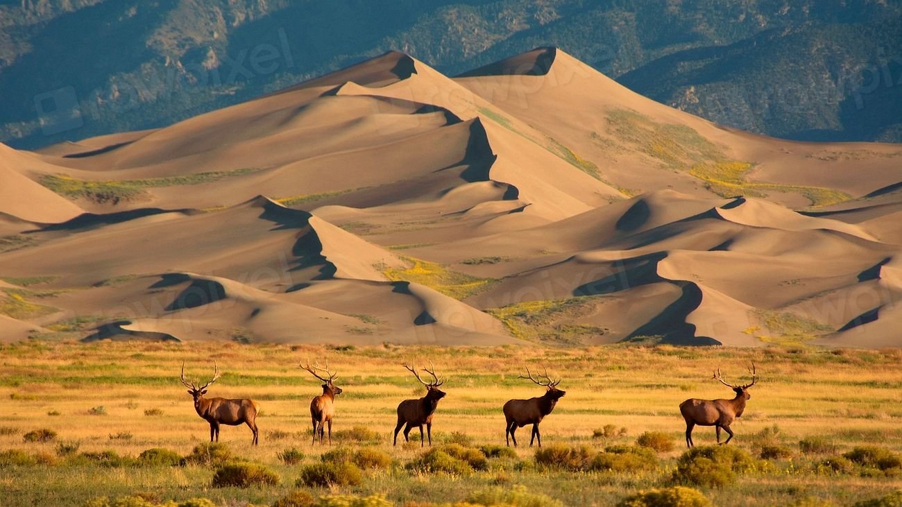
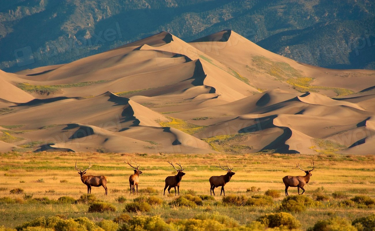
#5. Great Sand Dunes National Park, Colorado – The Tallest Dunes in North America
 0
0

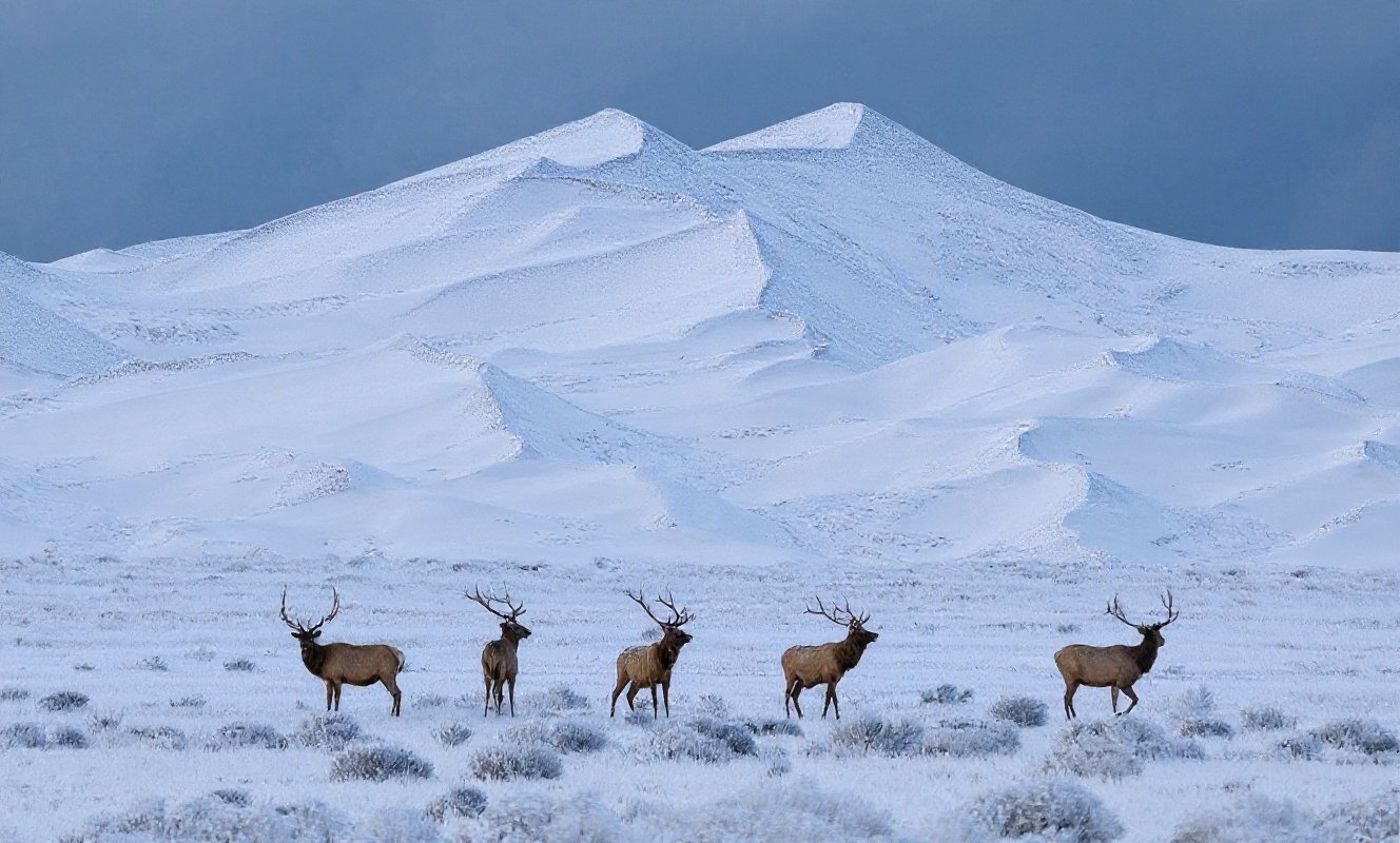
Most people don’t connect Colorado with sand dunes. That surprise is exactly what makes this place hit so hard. Tucked against the Sangre de Cristo Mountains in southern Colorado, Great Sand Dunes is home to the tallest and widest sand dunes in North America – rising to a maximum height of 750 feet from the floor of the San Luis Valley. The dunes cover roughly 30 square miles and are estimated to contain over 1.2 cubic miles of sand, built over thousands of years as opposing winds swept material from the valley floor into the mountain wall, where it piled up and stayed.
The visual contrast is like something from two different worlds colliding. Behind the dunes, the Sangre de Cristo peaks soar to over 13,000 feet. In front, Medano Creek runs ice-cold across the dune base each spring before vanishing completely into the sand. You can stand ankle-deep in freezing water while the sun bakes the dune face above you at a completely different temperature. There’s nothing else like it.
Worth Knowing
- Tallest dune: Star Dune, measuring approximately 741 feet above the valley floor
- Hidden depth: An additional 350 feet of sand lies below the valley floor beneath the dunes
- Dune field size: About 30 square miles – the largest in North America
- Medano Creek: Appears each spring from snowmelt, then disappears entirely into the sand by summer
- Human history: Archaeological evidence places people here over 11,000 years ago
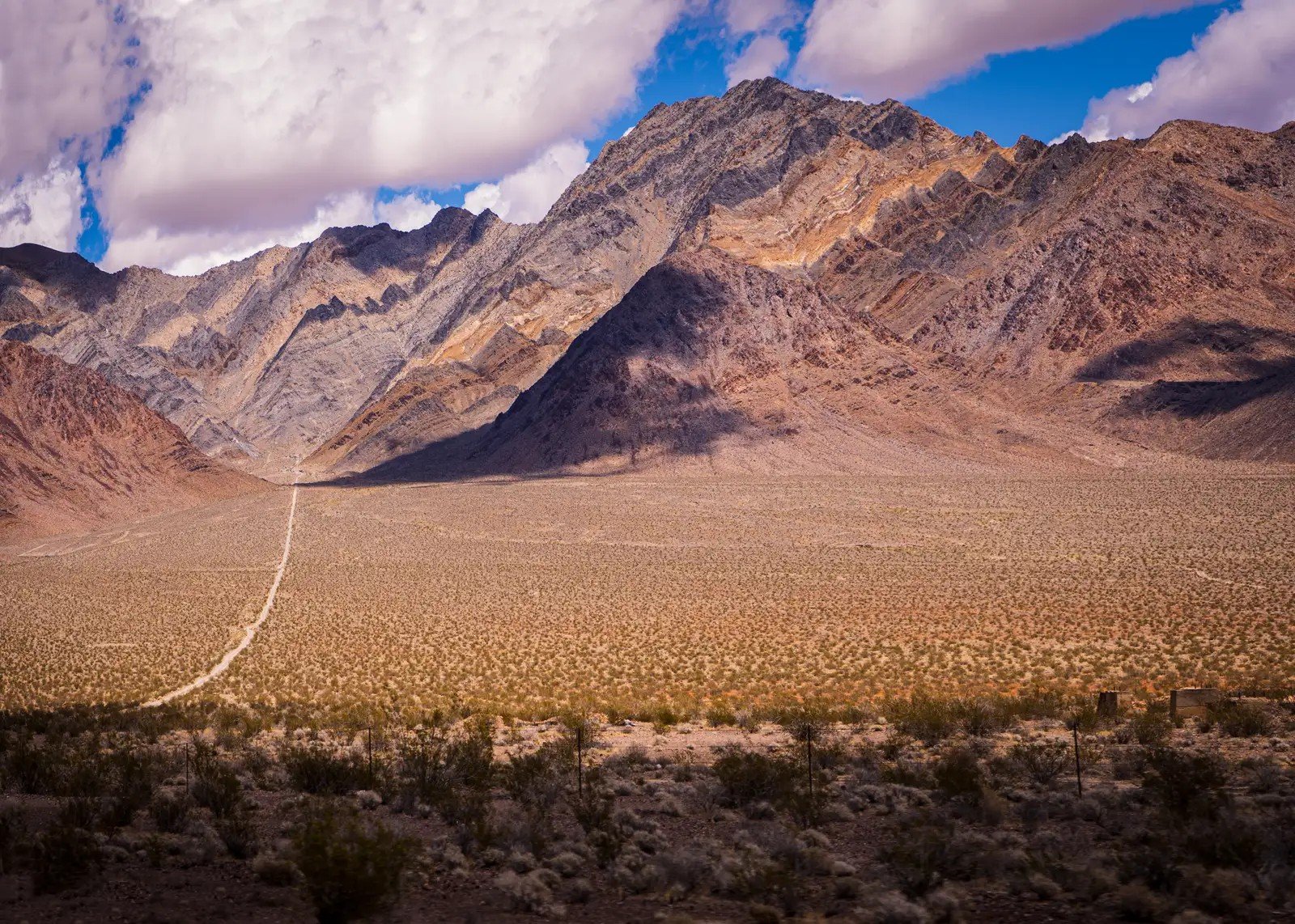
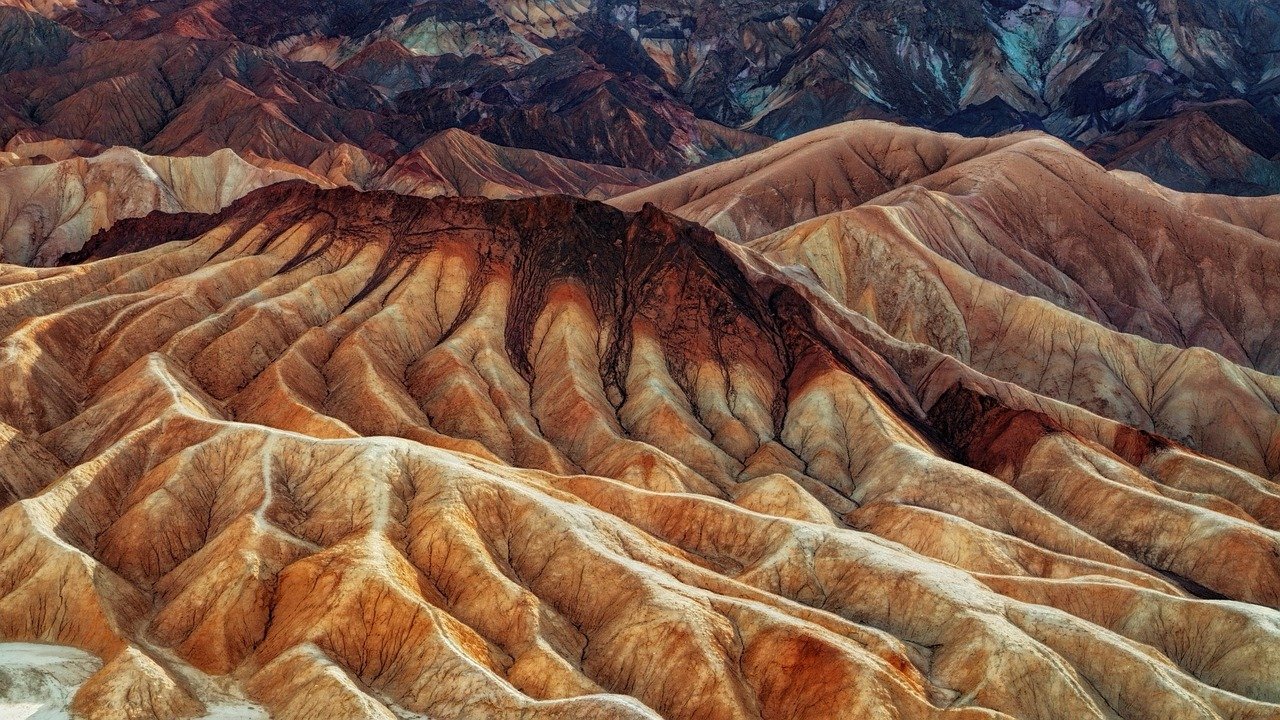
#4. Death Valley, California – The Hottest Place on Earth

On July 10, 1913, a temperature of 134°F was recorded at Furnace Creek in Death Valley – the highest atmospheric temperature ever documented on Earth’s surface. That record is more than a century old. It still hasn’t been broken.
Death Valley’s Badwater Basin sits 282 feet below sea level, the lowest point in North America. The valley is also the driest place in the United States, averaging just 2.36 inches of rain per year. The summer of 2024 broke records across the board: the park recorded nine consecutive days at 125°F or above, with a peak of 129.2°F on July 7 – making it the hottest meteorological summer in Death Valley’s recorded history, with an average 24-hour temperature of 104.5°F. Overnight lows averaged 91.9°F, meaning there was almost no relief after dark. And yet – impossibly – more than 1,000 plant species make their home here. Death Valley kills and creates at the same time.
#3. Denali, Alaska – The Tallest Mountain in North America, With Weather That Ends Expeditions
 0
0
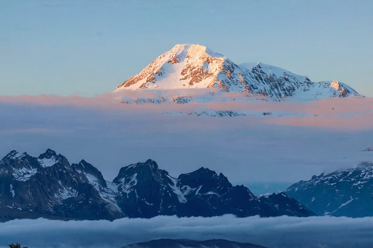
Denali rises 20,310 feet above sea level – the highest point in North America, standing 5,826 feet taller than California’s Mount Whitney, the second-highest peak in the contiguous U.S. That gap alone is wider than the entire vertical range of most eastern states.
But height is almost beside the point. What separates Denali is its violence. Storms materialize within hours. Temperatures on the upper mountain routinely fall to -40°F. Winds can exceed 100 mph. Because Denali sits so far north, the thinner atmosphere at its latitude makes the altitude feel more punishing than comparable peaks elsewhere. Climbers train for months and still turn back. Alaska’s Prospect Creek recorded -80°F in January 1971 – the coldest temperature ever recorded in the United States – and Denali’s summit environment puts you disturbingly close to that category of cold.
The mountain doesn’t care about your ambitions. It only cares about the weather.
Common refrain among Denali climbing guides
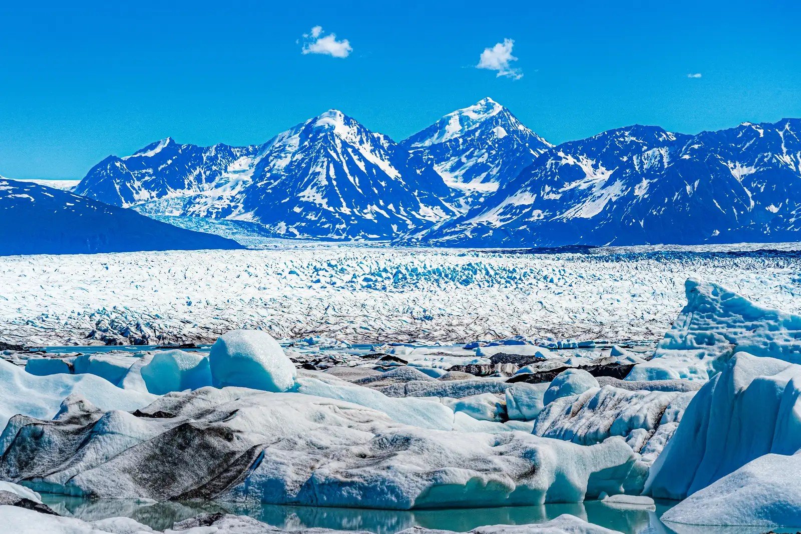
#2. Kenai Fjords National Park, Alaska – Where Glaciers Are Falling Into the Sea
 0
0

Kenai Fjords National Park covers 669,984 acres on Alaska’s Kenai Peninsula, and nearly half of it is buried under glacial ice. At its heart is the Harding Icefield – one of the largest icefields in the United States, covering roughly 700 square miles – the source of at least 38 glaciers, including Bear Glacier, the park’s largest. These aren’t static formations. They are moving, cracking, and retreating. Alaska’s glaciers are losing ice faster than any other glacierized region outside Antarctica and Greenland.
Bear Glacier retreated by about 5 kilometers (roughly 3 miles) between 1984 and 2021, and has also thinned about 2.5 feet per year over multiple decades. Take a boat tour today and you can watch tidewater glaciers calve in real time – massive walls of ancient blue ice fracturing and thundering into the sea directly in front of you. The sound arrives a moment after the ice falls, like distant cannon fire. It is one of the most powerful things a person can witness, and it becomes more rare with every passing year. See it while it’s still there to see.
Quick Compare: Kenai Fjords by the Numbers
- Park size: 669,984 acres – nearly half covered by glacial ice
- Harding Icefield: ~700 square miles; formed approximately 23,000 years ago
- Glaciers sourced: At least 38, with Bear Glacier the largest at ~17 miles long
- Bear Glacier retreat: ~3 miles (5 km) between 1984 and 2021
- Of 19 studied glaciers: 13 showed substantial retreat, 4 were stable, and just 2 advanced
America's Extreme Landscapes Quiz
Test your knowledge of the most dramatic geological wonders in the United States, from the depths of Death Valley to the peaks of Denali.
Think you caught the key details? Take the quick quiz and see how sharp your instincts really are.
#1. The Yellowstone Caldera to Death Valley Corridor – America’s Full Geological Spectrum in One Journey
 0
0
No single point on the map captures the full extremity of American landscape better than the diagonal corridor stretching from the Yellowstone supervolcano in Wyoming south through the Great Basin and down into Death Valley. Within roughly 1,000 miles, this route contains the world’s most active geothermal system, the largest cold desert on the continent, a prehistoric salt flat the size of a small city, and the hottest, lowest, driest place on Earth – all connected by open road.
No comparable stretch of highway on the planet takes you from boiling springs to ancient salt flats to glacially carved valleys to lunar desert in a single drive. The sheer range – geological, climatic, biological – compressed into one traversable journey is something that exists nowhere else. It is not one landscape. It is the argument for why America, geologically, belongs in a category of its own.
Drive it once and you’ll spend the rest of your life trying to explain what you saw to people who weren’t there. Most of them won’t fully believe you.